Area Overview for Woolacombe
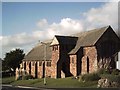
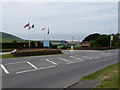
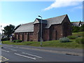
Photos of Woolacombe


Area Information
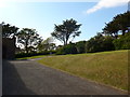
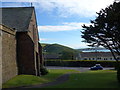
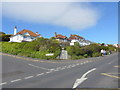
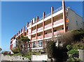
Woolacombe is a built-up coastal area in Devon, covering 75.6 hectares. It functions as a distinct residential zone within the broader town environment of Braunton and Ilfracombe rather than a standalone city. The locality appeals to those seeking proximity to the sea without being embedded in a dense urban centre. Life here revolves around the junction of quiet residential streets and the access provided to nearby commercial hubs. You will find a community defined by its connection to the coastline and its integration into the surrounding rural and coastal sprawl. The area offers a specific scale of living that balances accessibility with a slower pace compared to the main town centres further inland. Residents enjoy the convenience of being part of a developed settlement while retaining the benefits of lower population density found in smaller villages. This distinction makes Woolacombe a practical base for anyone prioritising coastal access over urban bustle. The layout supports a lifestyle where daily needs are met through proximity to Ilfracombe, yet the immediate surroundings provide a more tranquil setting. You are looking at an environment designed for those who value coastal living alongside established transport links to the rest of Devon. The area stands as a recognised residential community with clear boundaries and established infrastructure.
- Area Type
- Built Up Area 250
- Area Size
- 75.6 hectares
- Population
- Not available
- Population Density
- Not available
Daily life in Woolacombe benefits from access to essential amenities located nearby. Retail options include Spar Braunton, Co-op Ilfracombe, and Lidl Ilfacombe, which are within practical reach for weekly shopping. These supermarkets provide the standard range of groceries, household goods, and fresh produce required for a typical household. Transport links are supported by the Ilfracombe Ferry Landing, a covered ferry terminal situated 4.1 kilometres from the area. This facility connects Woolacombe to Bristol and South Wales at the end of the day, providing access to wider travel networks. The presence of these covered ferries ensures that maritime transport is a viable option for those travelling south despite the widening Severn Estuary during high tides. Residents can rely on these amenities to meet their daily needs without extensive travel planning. The combination of local retail and the ferry terminal offers a unique transport solution typical of the North Devon coast. You have the convenience of local stores combined with a direct link to the rest of the country by boat.
Amenities
Schools
Families considering schools near Woolacombe have two specific options within the local provision. Woolacombe School operates as a primary institution serving the younger demographic within the village. This establishment provides foundational education for children living in the immediate locality. For older students requiring secondary education, Woolacombe School also functions as an academy. This dual role indicates that the local educational infrastructure has evolved to meet the needs of the growing learner population. The academy holds a Good Ofsted rating, signalling a standard of education that meets national expectations for quality and safeguarding. While the primary section serves the immediate neighbourhood, the academy designation connects the local children to a broader network of educational resources. The presence of both a village school and an academy simplifies the education journey for families residing in Woolacombe. Parents do not need to search far for local provision, as the key institutions are situated within the built-up area. The mix ensures that younger families can access quality schooling without needing to commute to Ilfracombe or Braunton for their children's education.
| Rank | School | Type | Entry gender | Ages |
|---|
Explore more schools in this area
Go to Schools tabDemographics
The community in Woolacombe has an age profile skewed significantly towards older residents. The median age of the population stands at 70 years, placing it among the oldest local areas in the country. This demographic shift defines the social dynamics of the neighbourhood, where retirement and later-life living are the dominant factors. You will find that the majority of households consist of older adults managing independent living rather than young families raising children. These structural trends reflect the area's attractiveness to those seeking a quieter retirement phase in a coastal setting. Home ownership is exceptionally high within this community, with 77 per cent of residences occupied by their owners. This figure indicates a strong sense of settled residence and long-term commitment from the local population. The accommodation mix and ownership statistics suggest that the housing stock caters primarily to those with significant savings or pension wealth. The population composition lacks the diversity often found in younger, faster-growing metropolitan centres. Instead, the social fabric is built upon shared experiences of retirement and the specific preferences of older generations choosing this location over other options.
Household Size
Accommodation Type
Tenure
Ethnic Group
Religion
Household Composition
Age
Household Deprivation
NS-SEC
Explore more demographic insights in this area
Go to Demographics tabPlanning
Planning Constraints
- Crime RiskPremium