Area Overview for Winterborne Zelston
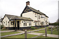
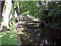
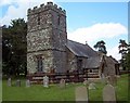
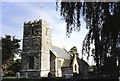
Photos of Winterborne Zelston


Area Information
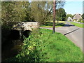
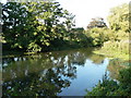
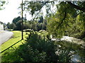
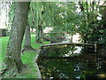
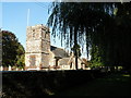
Winterborne Zelston is a civil parish located in Dorset, covering an area of 3.4 square kilometres. The community offers a defined residential setting where daily life revolves around a relatively compact footprint. You will find a neighbourhood that operates independently from larger urban centres, providing a distinct sense of place. This small parish serves as a settled community rather than a sprawling district. Residents here experience a lifestyle characterised by proximity to local amenities within the parish boundaries. The total land size limits rapid expansion, which helps maintain the established character of the settlement. You are entering a market where property choices reflect the established nature of this specific parish. Living in Winterborne Zelston means adopting a routine centred on this recognised legal and geographical entity. The area functions as a complete unit for local governance and community recognition. Your potential new home sits within these clear boundaries, separating it from adjacent settlements. You can rely on the parish structure to provide a familiar administrative framework for your residence. Homes in Winterborne Zelston represent a specific commitment to this particular, bounded postcode district.
- Area Type
- Parish
- Area Size
- 3.4 km²
- Population
- Not available
- Population Density
- Not available
Demographics
The resident population of Winterborne Zelston reflects a settled community with a median age of 70. This figure indicates that older residents form a significant portion of the local population. You will encounter a demographic profile typical of retirement locations or established villages where families have moved on. The most common age range statistic confirms that the total population skews heavily towards the senior end of the spectrum. Home ownership stands at 66% of the total, meaning most people in the parish own their properties outright. This high rate of ownership suggests a long-term population rather than a transient rental market. The household composition data describes the total structure of families and singles within this parish. Accommodation types encompass the total range of structures available in the district. While specific details on predominant ethnic groups and religious affiliations are not detailed in the current record, the existing statistics paint a picture of a homogenous, owner-occupied cohort. The community structure relies heavily on tenure status rather than mixed rental populations. You should expect to live amongst neighbours who have resided in the area for considerable periods. The age profile directly influences the energy and type of social activities available in Winterborne Zelston compared to younger urban districts.
Household Size
Accommodation Type
Tenure
Ethnic Group
Religion
Household Composition
Age
Household Deprivation
NS-SEC
Explore more demographic insights in this area
Go to Demographics tabPlanning
Planning Constraints
- Flood RiskPremium
- Ramsar Wetland SitesPremium
- Area of Outstanding Natural BeautyPremium
- Protected Nature ReservePremium
- Protected WoodlandPremium
- Crime RiskPremium