Area Overview for Broad Chalke
Photos of Broad Chalke


Area Information
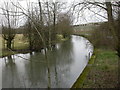
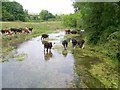
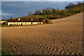
Living in Broad Chalke offers a distinct experience within a civil parish spanning 28.2 square kilometres. This rural location in England serves as a quiet backdrop for those seeking space and a slower pace of life. The area defines itself through its substantial size, providing ample room for independent living away from densely populated towns. You find yourself in a setting where daily rhythms are shaped by the openness of the countryside rather than urban congestion. Residents here enjoy a sense of seclusion that comes from the specific geography of the parish. The landscape encourages outdoor activities and provides a buffer from the noise of major transportation hubs. Daily life revolves around local amenities and community interaction within a defined boundary. The scale of the parish ensures that most residents have access to their natural surroundings without needing to travel far for leisure. This characteristic makes Broad Chalke a specific choice for individuals prioritising space and tranquility in their home environment.
- Area Type
- Parish
- Area Size
- 28.2 km²
- Population
- Not available
- Population Density
- Not available
Demographics
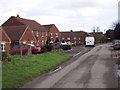
The community profile of Broad Chalke reflects a settled population with a significant proportion of older residents. Data indicates a median age of 70 years, suggesting the area attracts those post-retirement or nearing retirement age. Consequently, you will encounter a neighbourhood where life often focuses on leisure, family, and local engagement rather than the fast pace associated with younger demographics. A total population breakdown confirms this older age structure dominates the civilian demographic. Home ownership stands as the defining feature of the local economy, with 68% of residents owning their homes outright or with a mortgage. This figure signifies a stable, long-term community where house prices and rental yields reflect owner-occupier rates. Most households consist of individuals or couples, aligning with the older median age. The accommodation types present a mix likely suited to this age group, ranging from bungalows to larger family properties. You can expect a diverse ethnic makeup and a religious landscape typical of rural England, though specific statistics on these metrics remain part of the total household composition.
Household Size
Accommodation Type
Tenure
Ethnic Group
Religion
Household Composition
Age
Household Deprivation
NS-SEC
Explore more demographic insights in this area
Go to Demographics tabPlanning
Planning Constraints
- Flood RiskPremium
- Ramsar Wetland SitesPremium
- Area of Outstanding Natural BeautyPremium
- Protected Nature ReservePremium
- Protected WoodlandPremium