Area Overview for TR8 4NH
Photos of TR8 4NH

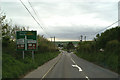
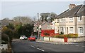
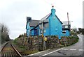


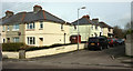


31 photos from this area
Area Information
Key information about the TR8 4NH including its size, population, and administrative classification.
- Area Type
- Postcode
- Area Size
- 5.2 hectares
- Population
- 1541
- Population Density
- 660 people/km²
House Prices in TR8 4NH
55
Properties
£170,132
Average Sold Price
£48,500
Lowest Price
£325,000
Highest Price
Showing 55 properties
| Address | Type | Beds | Baths | Last Sale Price | Last Sale Date | |
|---|---|---|---|---|---|---|
| 4 Gannel View Close, Lane, Newquay, TR8 4NH | Bungalow | 3 | 1 | £325,000 | Jan 2025 | |
| 5 Gannel View Close, Lane, Newquay, TR8 4NH | Bungalow | 2 | - | £240,000 | Jun 2023 | |
| 7 Gannel View Close, Lane, Newquay, TR8 4NH | Bungalow | 3 | 1 | £325,000 | Oct 2022 | |
| 19 Gannel View Close, Lane, Newquay, TR8 4NH | Bungalow | 3 | 1 | £290,000 | Sep 2021 | |
| 18 Gannel View Close, Lane, Newquay, TR8 4NH | Bungalow | - | - | £278,000 | Nov 2020 | |
| 10 Gannel View Close, Lane, Newquay, TR8 4NH | Semi-detached | 2 | 1 | £170,000 | Apr 2018 | |
| Fandragon, 6A Gannel View Close, Lane, Newquay, TR8 4NH | Land | 2 | - | £212,000 | Apr 2018 | |
| 26 Gannel View Close, Lane, Newquay, TR8 4NH | Bungalow | 2 | 1 | £140,000 | Jan 2018 | |
| 12 Gannel View Close, Lane, Newquay, TR8 4NH | Bungalow | 2 | - | £153,000 | Jan 2017 | |
| 44 Gannel View Close, Lane, Newquay, TR8 4NH | Semi-detached | 3 | 3 | £200,000 | Nov 2016 |
Page 1 of 6
Energy Efficiency in TR8 4NH
Amenities
Schools
| Rank | School | Type | Entry gender | Ages |
|---|
Explore more schools in this area
Go to Schools tabDemographics
Household Size
Family (3-5 people)
most common
Accommodation Type
Houses
most common
Tenure
67
majority
Ethnic Group
White
most common
Religion
N/A
most common
Household Composition
N/A
most common
Age
47
median
Adults (30-64 years)
most common
Household Deprivation
N/A
with no deprivation
NS-SEC
29
in Lower managerial occupations
Explore more demographic insights in this area
Go to Demographics tabPlanning
Planning Constraints
- Flood RiskPremium
- Ramsar Wetland SitesPremium
- Area of Outstanding Natural BeautyPremium
- Protected Nature ReservePremium
- Protected WoodlandPremium