Area Overview for TR7 2JQ
Photos of TR7 2JQ
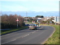
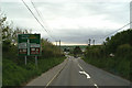
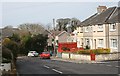
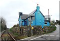

31 photos from this area
Area Information
Key information about the TR7 2JQ including its size, population, and administrative classification.
- Area Type
- Postcode
- Area Size
- 1.3 hectares
- Population
- 1541
- Population Density
- 660 people/km²
House Prices in TR7 2JQ
16
Properties
£157,158
Average Sold Price
£41,000
Lowest Price
£257,500
Highest Price
Showing 16 properties
| Address | Type | Beds | Baths | Last Sale Price | Last Sale Date | |
|---|---|---|---|---|---|---|
| 134 Treloggan Road, Newquay, TR7 2JQ | Terraced | 3 | 1 | £257,500 | Dec 2022 | |
| 126 Treloggan Road, Newquay, TR7 2JQ | house | - | - | £225,000 | Jun 2021 | |
| 122 Treloggan Road, Newquay, TR7 2JQ | Terraced | 3 | 1 | £198,000 | Aug 2018 | |
| 128 Treloggan Road, Newquay, TR7 2JQ | house | 3 | - | £161,500 | Nov 2006 | |
| 132 Treloggan Road, Newquay, TR7 2JQ | house | - | - | £59,950 | Jul 2000 | |
| 130 Treloggan Road, Newquay, TR7 2JQ | house | - | - | £41,000 | Feb 1996 | |
| 83 Treloggan Road, Newquay, TR7 2JQ | Land | 8 | 8 | - | - | |
| Gridl - The Cornish Breakfast Co, Booker Cash And Carry, Treloggan Industrial Estate, Newquay, TR7 2JQ | Restaurant | - | - | - | - | |
| 73 Treloggan Road, Newquay, TR7 2JQ | house | - | - | - | - | |
| 77 Treloggan Road, Newquay, TR7 2JQ | house | - | - | - | - |
Page 1 of 2
Energy Efficiency in TR7 2JQ
Amenities
Schools
| Rank | School | Type | Entry gender | Ages |
|---|
Explore more schools in this area
Go to Schools tabDemographics
Household Size
Family (3-5 people)
most common
Accommodation Type
Houses
most common
Tenure
67
majority
Ethnic Group
White
most common
Religion
N/A
most common
Household Composition
N/A
most common
Age
47
median
Adults (30-64 years)
most common
Household Deprivation
N/A
with no deprivation
NS-SEC
29
in Lower managerial occupations
Explore more demographic insights in this area
Go to Demographics tabPlanning
Planning Constraints
- Flood RiskPremium
- Ramsar Wetland SitesPremium
- Area of Outstanding Natural BeautyPremium
- Protected Nature ReservePremium
- Protected WoodlandPremium