Area Overview for TR7 1PF
Photos of TR7 1PF
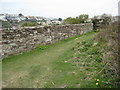
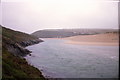
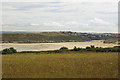
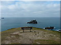
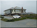
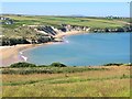
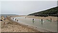
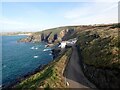
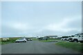
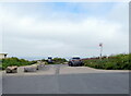
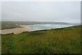
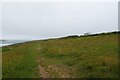
49 photos from this area
Area Information
Key information about the TR7 1PF including its size, population, and administrative classification.
- Area Type
- Postcode
- Area Size
- 8.5 hectares
- Population
- 1728
- Population Density
- 325 people/km²
House Prices in TR7 1PF
34
Properties
£466,667
Average Sold Price
£180,000
Lowest Price
£775,000
Highest Price
Showing 34 properties
| Address | Type | Beds | Baths | Last Sale Price | Last Sale Date | |
|---|---|---|---|---|---|---|
| 68 Pentire Avenue, Newquay, TR7 1PF | Terraced | 3 | 2 | £775,000 | Jul 2022 | |
| 97 Pentire Avenue, Newquay, TR7 1PF | Semi-detached | 3 | 2 | £575,000 | Nov 2020 | |
| 111 Pentire Avenue, Newquay, TR7 1PF | Bungalow | 3 | 2 | £560,000 | Jun 2019 | |
| 103 Pentire Avenue, Newquay, TR7 1PF | Bungalow | 3 | 2 | £580,000 | Jan 2019 | |
| 101 Pentire Avenue, Newquay, TR7 1PF | Bungalow | 3 | 2 | £305,000 | Feb 2015 | |
| 99 Pentire Avenue, Newquay, TR7 1PF | Detached | 7 | 8 | £345,000 | Feb 2010 | |
| 115 Pentire Avenue, Newquay, TR7 1PF | Bungalow | - | - | £700,000 | May 2007 | |
| 109 Pentire Avenue, Newquay, TR7 1PF | Detached | - | - | £180,000 | Nov 2002 | |
| 107 Pentire Avenue, Newquay, TR7 1PF | Detached | - | - | £180,000 | Jul 2000 | |
| Flat 5, Vayn Prasada, 95 Pentire Avenue, Newquay, TR7 1PF | Flat | 1 | 1 | - | - |
Page 1 of 4
Energy Efficiency in TR7 1PF
Amenities
Schools
| Rank | School | Type | Entry gender | Ages |
|---|
Explore more schools in this area
Go to Schools tabDemographics
Household Size
Two person
most common
Accommodation Type
Houses
most common
Tenure
63
majority
Ethnic Group
White
most common
Religion
N/A
most common
Household Composition
N/A
most common
Age
47
median
Adults (30-64 years)
most common
Household Deprivation
N/A
with no deprivation
NS-SEC
34
in Lower managerial occupations
Explore more demographic insights in this area
Go to Demographics tabPlanning
Planning Constraints
- Flood RiskPremium
- Ramsar Wetland SitesPremium
- Area of Outstanding Natural BeautyPremium
- Protected Nature ReservePremium
- Protected WoodlandPremium