Area Overview for TR7 1NY
Photos of TR7 1NY
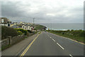
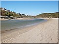
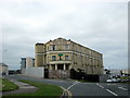

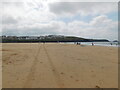
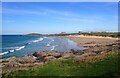
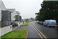
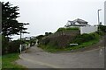
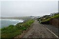
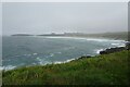
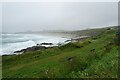
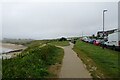
55 photos from this area
Area Information
Key information about the TR7 1NY including its size, population, and administrative classification.
- Area Type
- Postcode
- Area Size
- 6006 m²
- Population
- 2087
- Population Density
- 2761 people/km²
House Prices in TR7 1NY
25
Properties
£186,762
Average Sold Price
£47,500
Lowest Price
£380,000
Highest Price
Showing 25 properties
| Address | Type | Beds | Baths | Last Sale Price | Last Sale Date | |
|---|---|---|---|---|---|---|
| 1, Farfield Place, Pentire Avenue, Newquay, TR7 1NY | Terraced | 4 | 2 | £380,000 | Sep 2024 | |
| 5, Farfield Place, Pentire Avenue, Newquay, TR7 1NY | house | - | - | £330,000 | Mar 2023 | |
| 13, Farfield Place, Pentire Avenue, Newquay, TR7 1NY | Terraced | 3 | 1 | £250,000 | Jan 2020 | |
| 4, Farfield Place, Pentire Avenue, Newquay, TR7 1NY | house | - | - | £290,000 | Jan 2020 | |
| 16, Farfield Place, Pentire Avenue, Newquay, TR7 1NY | house | 2 | - | £250,000 | Nov 2019 | |
| 3, Farfield Place, Pentire Avenue, Newquay, TR7 1NY | house | - | - | £240,000 | Nov 2019 | |
| 26, Farfield Place, Pentire Avenue, Newquay, TR7 1NY | house | - | - | £250,000 | Mar 2019 | |
| 24, Farfield Place, Pentire Avenue, Newquay, TR7 1NY | Terraced | 2 | 1 | £223,050 | Dec 2018 | |
| 12, Farfield Place, Pentire Avenue, Newquay, TR7 1NY | Terraced | 2 | 1 | £184,950 | Mar 2018 | |
| 22, Farfield Place, Pentire Avenue, Newquay, TR7 1NY | Terraced | - | - | £136,000 | Jan 2016 |
Page 1 of 3
Energy Efficiency in TR7 1NY
Amenities
Schools
| Rank | School | Type | Entry gender | Ages |
|---|
Explore more schools in this area
Go to Schools tabDemographics
Household Size
Two person
most common
Accommodation Type
Houses
most common
Tenure
73
majority
Ethnic Group
White
most common
Religion
N/A
most common
Household Composition
N/A
most common
Age
47
median
Adults (30-64 years)
most common
Household Deprivation
N/A
with no deprivation
NS-SEC
36
in Lower managerial occupations
Explore more demographic insights in this area
Go to Demographics tabPlanning
Planning Constraints
- Flood RiskPremium
- Ramsar Wetland SitesPremium
- Area of Outstanding Natural BeautyPremium
- Protected Nature ReservePremium
- Protected WoodlandPremium