Area Overview for TR7 1LX
Photos of TR7 1LX


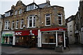
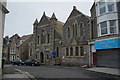
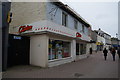
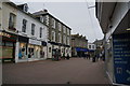

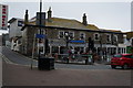
100 photos from this area
Area Information
Key information about the TR7 1LX including its size, population, and administrative classification.
- Area Type
- Postcode
- Area Size
- 6146 m²
- Population
- 1678
- Population Density
- 4578 people/km²
House Prices in TR7 1LX
38
Properties
£248,900
Average Sold Price
£77,000
Lowest Price
£410,000
Highest Price
Showing 38 properties
| Address | Type | Beds | Baths | Last Sale Price | Last Sale Date | |
|---|---|---|---|---|---|---|
| 75 Tower Road, Newquay, TR7 1LX | Semi-detached | 6 | 3 | £395,000 | Jan 2023 | |
| 83 Tower Road, Newquay, TR7 1LX | Flat | 3 | 2 | £410,000 | Nov 2021 | |
| Chy Trethek, 65B Tower Road, Newquay, TR7 1LX | Detached | - | - | £215,000 | Sep 2003 | |
| 79 Tower Road, Newquay, TR7 1LX | house | - | - | £147,500 | Aug 2002 | |
| 77 Tower Road, Newquay, TR7 1LX | Terraced | - | - | £77,000 | Dec 1999 | |
| Flat 7, 87 Tower Road, Newquay, TR7 1LX | Unknown | - | - | - | - | |
| Flat 1, 87 Tower Road, Newquay, TR7 1LX | Unknown | - | - | - | - | |
| Rear Flat, 87 Tower Road, Newquay, TR7 1LX | Flat | 1 | 1 | - | - | |
| Top Flat, 85 Tower Road, Newquay, TR7 1LX | Flat | - | - | - | - | |
| Rear Annexe, 67 Tower Road, Newquay, TR7 1LX | Flat | - | - | - | - |
Page 1 of 4
Energy Efficiency in TR7 1LX
Amenities
Schools
| Rank | School | Type | Entry gender | Ages |
|---|
Explore more schools in this area
Go to Schools tabDemographics
Household Size
One person
most common
Accommodation Type
Flats
most common
Tenure
44
majority
Ethnic Group
White
most common
Religion
N/A
most common
Household Composition
N/A
most common
Age
47
median
Adults (30-64 years)
most common
Household Deprivation
N/A
with no deprivation
NS-SEC
26
in Lower managerial occupations
Explore more demographic insights in this area
Go to Demographics tabPlanning
Planning Constraints
- Flood RiskPremium
- Ramsar Wetland SitesPremium
- Area of Outstanding Natural BeautyPremium
- Protected Nature ReservePremium
- Protected WoodlandPremium