Area Overview for TR6 0FB
Photos of TR6 0FB
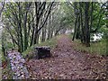
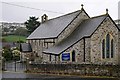
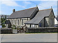
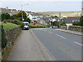
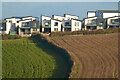
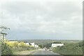
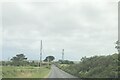
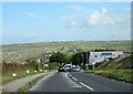
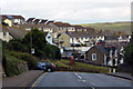
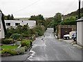
11 photos from this area
Area Information
Key information about the TR6 0FB including its size, population, and administrative classification.
- Area Type
- Postcode
- Area Size
- 3.9 hectares
- Population
- 1728
- Population Density
- 1294 people/km²
House Prices in TR6 0FB
34
Properties
£307,774
Average Sold Price
£131,000
Lowest Price
£525,000
Highest Price
Showing 34 properties
| Address | Type | Beds | Baths | Last Sale Price | Last Sale Date | |
|---|---|---|---|---|---|---|
| 34 Bethan View, Perranporth, TR6 0FB | Detached | 3 | 2 | £525,000 | May 2025 | |
| 29 Bethan View, Perranporth, TR6 0FB | Detached | 4 | - | £525,000 | Feb 2025 | |
| 33 Bethan View, Perranporth, TR6 0FB | Detached | 3 | 2 | £450,000 | Aug 2024 | |
| 17 Bethan View, Perranporth, TR6 0FB | Land | 4 | 2 | £391,500 | Mar 2020 | |
| 30 Bethan View, Perranporth, TR6 0FB | Detached | 4 | 2 | £395,000 | Aug 2018 | |
| 15 Bethan View, Perranporth, TR6 0FB | Detached | 4 | 3 | £370,000 | Jul 2017 | |
| 28 Bethan View, Perranporth, TR6 0FB | Detached | 4 | - | £347,500 | Dec 2016 | |
| 32 Bethan View, Perranporth, TR6 0FB | house | - | - | £380,000 | Jan 2016 | |
| 19 Bethan View, Perranporth, TR6 0FB | Detached | 4 | 3 | £131,000 | Oct 2015 | |
| 20 Bethan View, Perranporth, TR6 0FB | house | - | - | £131,000 | Sep 2015 |
Page 1 of 4
Energy Efficiency in TR6 0FB
Amenities
Schools
| Rank | School | Type | Entry gender | Ages |
|---|
Explore more schools in this area
Go to Schools tabDemographics
Household Size
Two person
most common
Accommodation Type
Houses
most common
Tenure
74
majority
Ethnic Group
White
most common
Religion
N/A
most common
Household Composition
N/A
most common
Age
47
median
Adults (30-64 years)
most common
Household Deprivation
N/A
with no deprivation
NS-SEC
37
in Lower managerial occupations
Explore more demographic insights in this area
Go to Demographics tabPlanning
Planning Constraints
- Flood RiskPremium
- Ramsar Wetland SitesPremium
- Area of Outstanding Natural BeautyPremium
- Protected Nature ReservePremium
- Protected WoodlandPremium