Area Overview for TR5 0UF
Photos of TR5 0UF
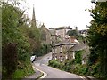
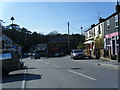
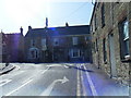
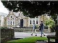
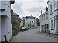
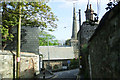
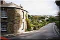
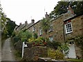
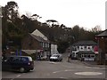
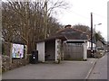
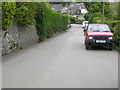
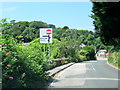
63 photos from this area
Area Information
Key information about the TR5 0UF including its size, population, and administrative classification.
- Area Type
- Postcode
- Area Size
- 1.6 hectares
- Population
- 1311
- Population Density
- 1128 people/km²
House Prices in TR5 0UF
16
Properties
£466,950
Average Sold Price
£200,000
Lowest Price
£900,000
Highest Price
Showing 16 properties
| Address | Type | Beds | Baths | Last Sale Price | Last Sale Date | |
|---|---|---|---|---|---|---|
| 45 Rosemundy, St Agnes, TR5 0UF | Cottage | 2 | 1 | £355,000 | Sep 2025 | |
| 2 Rosemundy, St Agnes, TR5 0UF | Terraced | 3 | 1 | £510,000 | May 2025 | |
| 3 Rosemundy, St Agnes, TR5 0UF | house | - | - | £512,000 | Mar 2025 | |
| 1 Rosemundy, St Agnes, TR5 0UF | Terraced | 4 | - | £670,000 | Jun 2023 | |
| 5 Rosemundy, St Agnes, TR5 0UF | Detached | 6 | - | £900,000 | Sep 2019 | |
| 4 Rosemundy, St Agnes, TR5 0UF | Terraced | 3 | 1 | £495,000 | Jul 2017 | |
| 44 Rosemundy, St Agnes, TR5 0UF | house | 2 | - | £200,000 | Dec 2010 | |
| 42 Rosemundy, St Agnes, TR5 0UF | Detached | - | - | £425,000 | Oct 2007 | |
| 43 Rosemundy, St Agnes, TR5 0UF | house | - | - | £362,500 | Jun 2007 | |
| Bryally Cottage, 50 Rosemundy, St Agnes, TR5 0UF | Terraced | 4 | - | £240,000 | Sep 2003 |
Page 1 of 2
Energy Efficiency in TR5 0UF
Amenities
Schools
| Rank | School | Type | Entry gender | Ages |
|---|
Explore more schools in this area
Go to Schools tabDemographics
Household Size
One person
most common
Accommodation Type
Houses
most common
Tenure
61
majority
Ethnic Group
White
most common
Religion
N/A
most common
Household Composition
N/A
most common
Age
47
median
Adults (30-64 years)
most common
Household Deprivation
N/A
with no deprivation
NS-SEC
43
in Lower managerial occupations
Explore more demographic insights in this area
Go to Demographics tabPlanning
Planning Constraints
- Flood RiskPremium
- Ramsar Wetland SitesPremium
- Area of Outstanding Natural BeautyPremium
- Protected Nature ReservePremium
- Protected WoodlandPremium