Area Overview for TR3 6AR
Photos of TR3 6AR
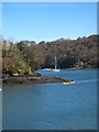
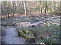
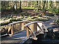
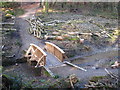
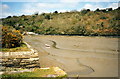
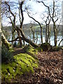
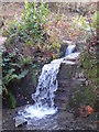
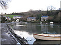
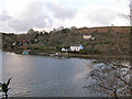
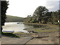
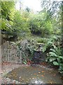
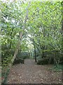
43 photos from this area
Area Information
Key information about the TR3 6AR including its size, population, and administrative classification.
- Area Type
- Postcode
- Area Size
- 41.2 hectares
- Population
- 2087
- Population Density
- 86 people/km²
House Prices in TR3 6AR
18
Properties
£360,833
Average Sold Price
£210,000
Lowest Price
£637,500
Highest Price
Showing 18 properties
| Address | Type | Beds | Baths | Last Sale Price | Last Sale Date | |
|---|---|---|---|---|---|---|
| Creek View, Road From Higher Lanner To Coombe, Coombe, Kea, TR3 6AR | Cottage | 3 | - | £637,500 | Nov 2020 | |
| 2, River View, Road From Higher Lanner To Coombe, Coombe, Kea, TR3 6AR | Terraced | 3 | 1 | £235,000 | Sep 2012 | |
| 4, River View, Road From Higher Lanner To Coombe, Coombe, Kea, TR3 6AR | Terraced | 3 | 1 | £210,000 | Jul 2011 | |
| The Brake, Access To Roseville From Coombe, Coombe, Kea, TR3 6AR | Detached | 3 | 1 | - | - | |
| Hillside, Access To Beach Cottage From Coombe, Coombe, Kea, TR3 6AR | Semi-detached | - | - | - | - | |
| The Tregothnan Shepherds Hut At Coombe, Access To Beach Cottage From Coombe, Coombe, Kea, TR3 6AR | hotel | - | - | - | - | |
| Beach Cottage, Access To Beach Cottage From Coombe, Coombe, Kea, TR3 6AR | house | - | - | - | - | |
| 3, River View, Road From Higher Lanner To Coombe, Coombe, Kea, TR3 6AR | Terraced | - | - | - | - | |
| Roseville, Access To Roseville From Coombe, Coombe, Kea, TR3 6AR | Semi-detached | - | - | - | - | |
| Cliff Cottage, Access To Roseville From Coombe, Coombe, Kea, TR3 6AR | house | - | - | - | - |
Page 1 of 2
Energy Efficiency in TR3 6AR
Amenities
Schools
| Rank | School | Type | Entry gender | Ages |
|---|
Explore more schools in this area
Go to Schools tabDemographics
Household Size
Two person
most common
Accommodation Type
Houses
most common
Tenure
77
majority
Ethnic Group
White
most common
Religion
N/A
most common
Household Composition
N/A
most common
Age
47
median
Adults (30-64 years)
most common
Household Deprivation
N/A
with no deprivation
NS-SEC
44
in Lower managerial occupations
Explore more demographic insights in this area
Go to Demographics tabPlanning
Planning Constraints
- Flood RiskPremium
- Ramsar Wetland SitesPremium
- Area of Outstanding Natural BeautyPremium
- Protected Nature ReservePremium
- Protected WoodlandPremium