Area Overview for TR27 6HP
Photos of TR27 6HP
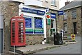
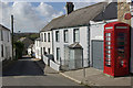
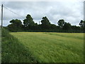
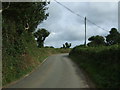
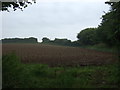
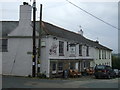
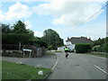
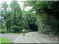
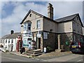
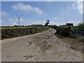
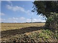
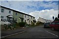
33 photos from this area
Area Information
Key information about the TR27 6HP including its size, population, and administrative classification.
- Area Type
- Postcode
- Area Size
- 1.4 hectares
- Population
- 2360
- Population Density
- 87 people/km²
House Prices in TR27 6HP
22
Properties
£218,492
Average Sold Price
£43,000
Lowest Price
£493,200
Highest Price
Showing 22 properties
| Address | Type | Beds | Baths | Last Sale Price | Last Sale Date | |
|---|---|---|---|---|---|---|
| 5 Church Street, St Erth, TR27 6HP | Terraced | 3 | 1 | £196,500 | Sep 2024 | |
| 16 Church Street, St Erth, TR27 6HP | house | - | - | £285,000 | Sep 2021 | |
| 18 Church Street, St Erth, TR27 6HP | Terraced | 3 | - | £195,000 | Jul 2021 | |
| Church House, 24 Church Street, St Erth, TR27 6HP | Detached | 4 | 2 | £376,252 | Apr 2019 | |
| 4 Church Street, St Erth, TR27 6HP | Terraced | 3 | 1 | £310,000 | Dec 2018 | |
| 13 Church Street, St Erth, TR27 6HP | Terraced | 3 | 1 | £174,950 | Oct 2016 | |
| 22 Church Street, St Erth, TR27 6HP | house | 3 | - | £160,000 | Jun 2010 | |
| 20 Church Street, St Erth, TR27 6HP | Terraced | - | - | £162,500 | Feb 2009 | |
| Lanuthnoe Cottage, 25 Church Street, St Erth, TR27 6HP | Semi-detached | - | - | £493,200 | May 2005 | |
| Christmas Cottage, 2 Church Street, St Erth, TR27 6HP | house | - | - | £188,000 | Oct 2004 |
Page 1 of 3
Energy Efficiency in TR27 6HP
Amenities
Schools
| Rank | School | Type | Entry gender | Ages |
|---|
Explore more schools in this area
Go to Schools tabDemographics
Household Size
Two person
most common
Accommodation Type
Houses
most common
Tenure
71
majority
Ethnic Group
White
most common
Religion
N/A
most common
Household Composition
N/A
most common
Age
47
median
Adults (30-64 years)
most common
Household Deprivation
N/A
with no deprivation
NS-SEC
33
in Lower managerial occupations
Explore more demographic insights in this area
Go to Demographics tabPlanning
Planning Constraints
- Flood RiskPremium
- Ramsar Wetland SitesPremium
- Area of Outstanding Natural BeautyPremium
- Protected Nature ReservePremium
- Protected WoodlandPremium