Area Overview for TR27 5HZ
Photos of TR27 5HZ
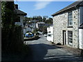


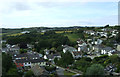


50 photos from this area
Area Information
Key information about the TR27 5HZ including its size, population, and administrative classification.
- Area Type
- Postcode
- Area Size
- 9.6 hectares
- Population
- 1531
- Population Density
- 197 people/km²
House Prices in TR27 5HZ
23
Properties
£249,377
Average Sold Price
£87,500
Lowest Price
£367,000
Highest Price
Showing 23 properties
| Address | Type | Beds | Baths | Last Sale Price | Last Sale Date | |
|---|---|---|---|---|---|---|
| 7 Grist Lane, Angarrack, TR27 5HZ | Bungalow | 2 | 1 | £335,000 | Jun 2025 | |
| 9 Grist Lane, Angarrack, TR27 5HZ | Detached | 3 | 1 | £330,000 | Mar 2025 | |
| 6, Hillside Court, Grist Lane, Angarrack, TR27 5HZ | Bungalow | 3 | 2 | £255,000 | Sep 2019 | |
| Bloomsbury, 1 Grist Lane, Angarrack, TR27 5HZ | Terraced | 3 | 2 | £367,000 | Sep 2019 | |
| 3, Hillside Court, Grist Lane, Angarrack, TR27 5HZ | Semi-detached | 2 | 2 | £197,500 | Jan 2019 | |
| 4, Hillside Court, Grist Lane, Angarrack, TR27 5HZ | Terraced | 2 | 1 | £250,000 | Dec 2018 | |
| 1, Hillside Court, Grist Lane, Angarrack, TR27 5HZ | Terraced | 3 | 2 | £287,000 | Jan 2017 | |
| Hilltop Cottage, 3 Grist Lane, Angarrack, TR27 5HZ | Detached | 5 | 2 | £335,000 | Nov 2016 | |
| The Sound, 6 Grist Lane, Angarrack, TR27 5HZ | Bungalow | 3 | - | £249,950 | Oct 2005 | |
| Angarrack Farm House, 12 Grist Lane, Angarrack, TR27 5HZ | Detached | 5 | 2 | £285,000 | Jan 2004 |
Page 1 of 3
Energy Efficiency in TR27 5HZ
Amenities
Schools
| Rank | School | Type | Entry gender | Ages |
|---|
Explore more schools in this area
Go to Schools tabDemographics
Household Size
Two person
most common
Accommodation Type
Houses
most common
Tenure
65
majority
Ethnic Group
White
most common
Religion
N/A
most common
Household Composition
N/A
most common
Age
47
median
Adults (30-64 years)
most common
Household Deprivation
N/A
with no deprivation
NS-SEC
28
in Lower managerial occupations
Explore more demographic insights in this area
Go to Demographics tabPlanning
Planning Constraints
- Flood RiskPremium
- Ramsar Wetland SitesPremium
- Area of Outstanding Natural BeautyPremium
- Protected Nature ReservePremium
- Protected WoodlandPremium