Area Overview for TR26 3JY
Photos of TR26 3JY
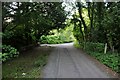
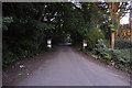
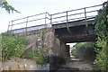
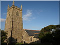

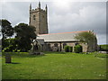
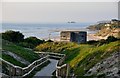
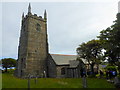
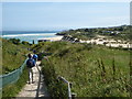
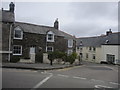
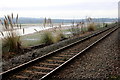
84 photos from this area
Area Information
Key information about the TR26 3JY including its size, population, and administrative classification.
- Area Type
- Postcode
- Area Size
- 7937 m²
- Population
- 2359
- Population Density
- 376 people/km²
House Prices in TR26 3JY
10
Properties
£343,408
Average Sold Price
£89,950
Lowest Price
£550,000
Highest Price
Showing 10 properties
| Address | Type | Beds | Baths | Last Sale Price | Last Sale Date | |
|---|---|---|---|---|---|---|
| 1 Fairfield Close, Lelant, TR26 3JY | Bungalow | 3 | 1 | £550,000 | Dec 2025 | |
| 5 Fairfield Close, Lelant, TR26 3JY | Bungalow | 2 | - | £500,000 | Aug 2021 | |
| 9 Fairfield Close, Lelant, TR26 3JY | Bungalow | 3 | 1 | £527,725 | Jun 2021 | |
| 2 Fairfield Close, Lelant, TR26 3JY | Bungalow | 2 | 2 | £360,000 | Jun 2021 | |
| Rosendale, 8 Fairfield Close, Lelant, TR26 3JY | Detached | 3 | - | £290,000 | Jan 2013 | |
| Jackdaws, 3 Fairfield Close, Lelant, TR26 3JY | Bungalow | 2 | - | £225,000 | Apr 2011 | |
| Lantyan, 4 Fairfield Close, Lelant, TR26 3JY | Detached | - | - | £273,000 | Dec 2009 | |
| Maer Cottage, 6 Fairfield Close, Lelant, TR26 3JY | Detached | - | - | £275,000 | Nov 2003 | |
| Bracklyn, 7 Fairfield Close, Lelant, TR26 3JY | Semi-detached | 3 | 2 | £89,950 | Apr 1996 | |
| Trevalyen, 12 Fairfield Close, Lelant, TR26 3JY | Detached | - | - | - | - |
Energy Efficiency in TR26 3JY
Amenities
Schools
| Rank | School | Type | Entry gender | Ages |
|---|
Explore more schools in this area
Go to Schools tabDemographics
Household Size
Two person
most common
Accommodation Type
Houses
most common
Tenure
80
majority
Ethnic Group
White
most common
Religion
N/A
most common
Household Composition
N/A
most common
Age
47
median
Adults (30-64 years)
most common
Household Deprivation
N/A
with no deprivation
NS-SEC
34
in Lower managerial occupations
Explore more demographic insights in this area
Go to Demographics tabPlanning
Planning Constraints
- Flood RiskPremium
- Ramsar Wetland SitesPremium
- Area of Outstanding Natural BeautyPremium
- Protected Nature ReservePremium
- Protected WoodlandPremium