Area Overview for TR26 3DW
Photos of TR26 3DW


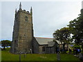

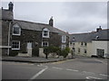

84 photos from this area
Area Information
Key information about the TR26 3DW including its size, population, and administrative classification.
- Area Type
- Postcode
- Area Size
- 1.6 hectares
- Population
- 2359
- Population Density
- 376 people/km²
House Prices in TR26 3DW
9
Properties
£461,000
Average Sold Price
£295,000
Lowest Price
£717,000
Highest Price
Showing 9 properties
| Address | Type | Beds | Baths | Last Sale Price | Last Sale Date | |
|---|---|---|---|---|---|---|
| Altrone, Riverside, Lelant, TR26 3DW | Bungalow | - | - | £415,000 | Sep 2021 | |
| The Elms, Riverside, Lelant, TR26 3DW | Semi-detached | 5 | 5 | £701,000 | Jun 2021 | |
| Rosebud, Riverside, Lelant, TR26 3DW | Detached | - | - | £380,000 | Jan 2017 | |
| The Firs, Riverside, Lelant, TR26 3DW | house | - | - | £717,000 | Jan 2016 | |
| Bailey Gate, Riverside, Lelant, TR26 3DW | Bungalow | 4 | - | £370,000 | Jun 2014 | |
| Fairlawns, Riverside, Lelant, TR26 3DW | Bungalow | 3 | - | £295,000 | Mar 2014 | |
| Riverside House, 1 Riverside, Lelant, TR26 3DW | Bungalow | 3 | - | £455,000 | Nov 2002 | |
| Tamruan, 2 Riverside, Lelant, TR26 3DW | Semi-detached | - | - | £355,000 | Oct 2002 | |
| 2 Riverside, Lelant, TR26 3DW | Semi-detached | 5 | - | - | - |
Energy Efficiency in TR26 3DW
Amenities
Schools
| Rank | School | Type | Entry gender | Ages |
|---|
Explore more schools in this area
Go to Schools tabDemographics
Household Size
Two person
most common
Accommodation Type
Houses
most common
Tenure
80
majority
Ethnic Group
White
most common
Religion
N/A
most common
Household Composition
N/A
most common
Age
47
median
Adults (30-64 years)
most common
Household Deprivation
N/A
with no deprivation
NS-SEC
34
in Lower managerial occupations
Explore more demographic insights in this area
Go to Demographics tabPlanning
Planning Constraints
- Flood RiskPremium
- Ramsar Wetland SitesPremium
- Area of Outstanding Natural BeautyPremium
- Protected Nature ReservePremium
- Protected WoodlandPremium