Area Overview for TR26 3BJ
Photos of TR26 3BJ
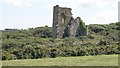
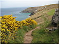
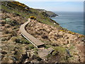
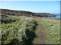
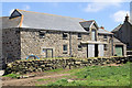
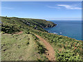
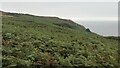
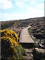
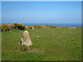
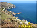
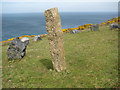
54 photos from this area
Area Information
Key information about the TR26 3BJ including its size, population, and administrative classification.
- Area Type
- Postcode
- Area Size
- 89.5 hectares
- Population
- 1557
- Population Density
- 235 people/km²
House Prices in TR26 3BJ
23
Properties
£270,000
Average Sold Price
£163,000
Lowest Price
£450,000
Highest Price
Showing 23 properties
| Address | Type | Beds | Baths | Last Sale Price | Last Sale Date | |
|---|---|---|---|---|---|---|
| Chyvean, Road From Trevalgan Road To Trevalgan, Trevalgan, TR26 3BJ | house | 3 | 2 | £450,000 | Jun 2021 | |
| Ruantallain, Road From Trevalgan Road To Trevalgan, Trevalgan, TR26 3BJ | Detached | 4 | - | £163,000 | Jan 2001 | |
| The Mowey, Road From Trevalgan Road To Trevalgan, Trevalgan, TR26 3BJ | Lodge | 3 | - | £197,000 | Oct 2000 | |
| Little Trevalgan, Road From Trevalgan Road To Trevalgan, Trevalgan, TR26 3BJ | Land | - | - | - | - | |
| Trecillian Barn, Road From Trevalgan Road To Trevalgan, Trevalgan, TR26 3BJ | Flat | 3 | - | - | - | |
| Land East Of An Jue Green Farm House, Road From Trevalgan Road To Trevalgan, Trevalgan, TR26 3BJ | Detached | - | - | - | - | |
| Trevalgan Farm, Road From Trevalgan Road To Trevalgan, Trevalgan, TR26 3BJ | Detached | - | - | - | - | |
| Anjou Barn, Road From Trevalgan Road To Trevalgan, Trevalgan, TR26 3BJ | Terraced | - | - | - | - | |
| Anjou Green Farm House, Road From Trevalgan Road To Trevalgan, Trevalgan, TR26 3BJ | Detached | - | - | - | - | |
| Anjou House, Road From Trevalgan Road To Trevalgan, Trevalgan, TR26 3BJ | house | - | - | - | - |
Page 1 of 3
Energy Efficiency in TR26 3BJ
Amenities
Schools
| Rank | School | Type | Entry gender | Ages |
|---|
Explore more schools in this area
Go to Schools tabDemographics
Household Size
Two person
most common
Accommodation Type
Houses
most common
Tenure
53
majority
Ethnic Group
White
most common
Religion
N/A
most common
Household Composition
N/A
most common
Age
47
median
Adults (30-64 years)
most common
Household Deprivation
N/A
with no deprivation
NS-SEC
23
in Lower managerial occupations
Explore more demographic insights in this area
Go to Demographics tabPlanning
Planning Constraints
- Flood RiskPremium
- Ramsar Wetland SitesPremium
- Area of Outstanding Natural BeautyPremium
- Protected Nature ReservePremium
- Protected WoodlandPremium