Area Overview for TR26 3AG
Photos of TR26 3AG
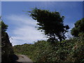
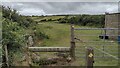
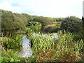
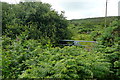
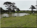
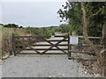
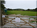
18 photos from this area
Area Information
Key information about the TR26 3AG including its size, population, and administrative classification.
- Area Type
- Postcode
- Area Size
- 67.9 hectares
- Population
- 2033
- Population Density
- 70 people/km²
House Prices in TR26 3AG
9
Properties
£182,750
Average Sold Price
£90,500
Lowest Price
£275,000
Highest Price
Showing 9 properties
| Address | Type | Beds | Baths | Last Sale Price | Last Sale Date | |
|---|---|---|---|---|---|---|
| Amalveor Bungalow, Road From Sweet Water Trout Farm To Embla, Amalveor, TR26 3AG | Bungalow | - | - | £275,000 | Aug 2018 | |
| Amalveor Farm, Road From Sweet Water Trout Farm To Embla, Amalveor, TR26 3AG | Detached | 3 | 2 | £90,500 | Aug 1997 | |
| Amalveor, Road From Sweet Water Trout Farm To Embla, Amalveor, TR26 3AG | Detached | 3 | 2 | - | - | |
| Embla Vean, Road From Sweet Water Trout Farm To Embla, Amalveor, TR26 3AG | Detached | 4 | 2 | - | - | |
| Amalveor Cottage, Road From Sweet Water Trout Farm To Embla, Amalveor, TR26 3AG | Detached | - | - | - | - | |
| Buthyn Dowr, Road From Sweet Water Trout Farm To Embla, Amalveor, TR26 3AG | Detached | - | - | - | - | |
| Treveth-an-amalveor, Road From Sweet Water Trout Farm To Embla, Amalveor, TR26 3AG | Bungalow | - | - | - | - | |
| The Mowey, Road From Sweet Water Trout Farm To Embla, Amalveor, TR26 3AG | house | 2 | - | - | - | |
| The Lodge, Embla Vean, Road From Sweet Water Trout Farm To Embla, Amalveor, TR26 3AG | Bungalow | - | - | - | - |
Energy Efficiency in TR26 3AG
Amenities
Schools
| Rank | School | Type | Entry gender | Ages |
|---|
Explore more schools in this area
Go to Schools tabDemographics
Household Size
Two person
most common
Accommodation Type
Houses
most common
Tenure
83
majority
Ethnic Group
White
most common
Religion
N/A
most common
Household Composition
N/A
most common
Age
47
median
Adults (30-64 years)
most common
Household Deprivation
N/A
with no deprivation
NS-SEC
32
in Lower managerial occupations
Explore more demographic insights in this area
Go to Demographics tabPlanning
Planning Constraints
- Flood RiskPremium
- Ramsar Wetland SitesPremium
- Area of Outstanding Natural BeautyPremium
- Protected Nature ReservePremium
- Protected WoodlandPremium