Area Overview for TR26 2LB
Photos of TR26 2LB
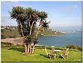
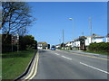
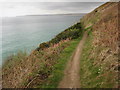
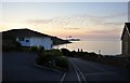
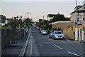
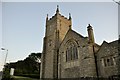


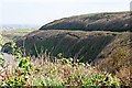
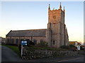
70 photos from this area
Area Information
Key information about the TR26 2LB including its size, population, and administrative classification.
- Area Type
- Postcode
- Area Size
- 8293 m²
- Population
- 1507
- Population Density
- 1243 people/km²
House Prices in TR26 2LB
10
Properties
£428,571
Average Sold Price
£90,000
Lowest Price
£570,000
Highest Price
Showing 10 properties
| Address | Type | Beds | Baths | Last Sale Price | Last Sale Date | |
|---|---|---|---|---|---|---|
| Jacaranda, Porthrepta Road, Carbis Bay, TR26 2LB | Detached | 3 | 1 | £435,000 | Mar 2024 | |
| Westways, Porthrepta Road, Carbis Bay, TR26 2LB | Bungalow | - | - | £570,000 | Dec 2022 | |
| Chy Mennor, Porthrepta Road, Carbis Bay, TR26 2LB | Detached | 4 | 3 | £570,000 | May 2021 | |
| Trelawne, Porthrepta Road, Carbis Bay, TR26 2LB | Semi-detached | 4 | 1 | £400,000 | Nov 2020 | |
| Nevek, Porthrepta Road, Carbis Bay, TR26 2LB | Detached | 4 | 2 | £455,000 | Aug 2013 | |
| Myrtos, Porthrepta Road, Carbis Bay, TR26 2LB | Bungalow | 4 | 4 | £480,000 | Apr 2010 | |
| Chylason, Porthrepta Road, Carbis Bay, TR26 2LB | Semi-detached | - | - | £90,000 | Jul 2001 | |
| Longstone Cottage, Porthrepta Road, Carbis Bay, TR26 2LB | Detached | - | - | - | - | |
| Grey Caps, Porthrepta Road, Carbis Bay, TR26 2LB | Detached | - | - | - | - | |
| Athol House, Porthrepta Road, Carbis Bay, TR26 2LB | Detached | - | - | - | - |
Energy Efficiency in TR26 2LB
Amenities
Schools
| Rank | School | Type | Entry gender | Ages |
|---|
Explore more schools in this area
Go to Schools tabDemographics
Household Size
Two person
most common
Accommodation Type
Houses
most common
Tenure
74
majority
Ethnic Group
White
most common
Religion
N/A
most common
Household Composition
N/A
most common
Age
47
median
Adults (30-64 years)
most common
Household Deprivation
N/A
with no deprivation
NS-SEC
30
in Lower managerial occupations
Explore more demographic insights in this area
Go to Demographics tabPlanning
Planning Constraints
- Flood RiskPremium
- Ramsar Wetland SitesPremium
- Area of Outstanding Natural BeautyPremium
- Protected Nature ReservePremium
- Protected WoodlandPremium