Area Overview for TR26 2HG
Photos of TR26 2HG
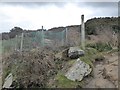
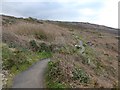
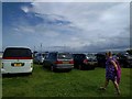
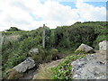
45 photos from this area
Area Information
Key information about the TR26 2HG including its size, population, and administrative classification.
- Area Type
- Postcode
- Area Size
- 2.3 hectares
- Population
- 1557
- Population Density
- 235 people/km²
House Prices in TR26 2HG
18
Properties
£334,750
Average Sold Price
£285,000
Lowest Price
£412,000
Highest Price
Showing 18 properties
| Address | Type | Beds | Baths | Last Sale Price | Last Sale Date | |
|---|---|---|---|---|---|---|
| Dreslan, Hellesvean, St Ives, TR26 2HG | Detached | 3 | 2 | £412,000 | May 2025 | |
| Karenza Cottage, Hellesvean, St Ives, TR26 2HG | house | - | - | £285,000 | Jun 2020 | |
| Peswar Gwyns, Hellesvean, St Ives, TR26 2HG | Bungalow | 2 | 1 | £335,000 | Sep 2019 | |
| Rosedale, Hellesvean, St Ives, TR26 2HG | Cottage | 2 | - | £285,000 | Jun 2014 | |
| Corner Cottage, Hellesvean, St Ives, TR26 2HG | Detached | 4 | - | £340,000 | Sep 2013 | |
| Myrtle Cottage, Hellesvean, St Ives, TR26 2HG | Semi-detached | - | - | £347,000 | Apr 2013 | |
| Happee House, Hellesvean, St Ives, TR26 2HG | Bungalow | - | - | £290,000 | Jan 2011 | |
| Sycamore Cottage, Hellesvean, St Ives, TR26 2HG | Detached | - | - | £384,000 | Sep 2008 | |
| Penburthy, Hellesvean, St Ives, TR26 2HG | Detached | 1 | 1 | - | - | |
| Vicarage, St Johns In The Fields, Hellesvean, St Ives, TR26 2HG | house | - | - | - | - |
Page 1 of 2
Energy Efficiency in TR26 2HG
Amenities
Schools
| Rank | School | Type | Entry gender | Ages |
|---|
Explore more schools in this area
Go to Schools tabDemographics
Household Size
Two person
most common
Accommodation Type
Houses
most common
Tenure
53
majority
Ethnic Group
White
most common
Religion
N/A
most common
Household Composition
N/A
most common
Age
47
median
Adults (30-64 years)
most common
Household Deprivation
N/A
with no deprivation
NS-SEC
23
in Lower managerial occupations
Explore more demographic insights in this area
Go to Demographics tabPlanning
Planning Constraints
- Flood RiskPremium
- Ramsar Wetland SitesPremium
- Area of Outstanding Natural BeautyPremium
- Protected Nature ReservePremium
- Protected WoodlandPremium