Area Overview for TR26 2EP
Photos of TR26 2EP
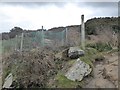
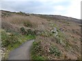
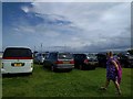
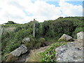
45 photos from this area
Area Information
Key information about the TR26 2EP including its size, population, and administrative classification.
- Area Type
- Postcode
- Area Size
- 4001 m²
- Population
- 1186
- Population Density
- 2702 people/km²
House Prices in TR26 2EP
10
Properties
£184,400
Average Sold Price
£62,000
Lowest Price
£420,000
Highest Price
Showing 10 properties
| Address | Type | Beds | Baths | Last Sale Price | Last Sale Date | |
|---|---|---|---|---|---|---|
| Uplands, Higher Stennack, St Ives, TR26 2EP | Semi-detached | 4 | 4 | £420,000 | Aug 2022 | |
| The Meadow, Higher Stennack, St Ives, TR26 2EP | Semi-detached | 3 | 1 | £257,000 | Mar 2021 | |
| Talanneth, Higher Stennack, St Ives, TR26 2EP | Detached | - | - | £110,000 | Oct 2000 | |
| Glen Crest, Higher Stennack, St Ives, TR26 2EP | house | - | - | £62,000 | Jul 1999 | |
| The Nest, Higher Stennack, St Ives, TR26 2EP | Detached | - | - | £73,000 | Sep 1998 | |
| 3, Trenwith Villas, Higher Stennack, St Ives, TR26 2EP | Terraced | 3 | - | - | - | |
| 1, Trenwith Villas, Higher Stennack, St Ives, TR26 2EP | house | 3 | - | - | - | |
| 2, Trenwith Villas, Higher Stennack, St Ives, TR26 2EP | Terraced | - | - | - | - | |
| The Annexe, Glen Crest, Higher Stennack, St Ives, TR26 2EP | Flat | - | - | - | - | |
| Bridge House, Higher Stennack, St Ives, TR26 2EP | Terraced | - | - | - | - |
Energy Efficiency in TR26 2EP
Amenities
Schools
| Rank | School | Type | Entry gender | Ages |
|---|
Explore more schools in this area
Go to Schools tabDemographics
Household Size
Two person
most common
Accommodation Type
Houses
most common
Tenure
77
majority
Ethnic Group
White
most common
Religion
N/A
most common
Household Composition
N/A
most common
Age
47
median
Adults (30-64 years)
most common
Household Deprivation
N/A
with no deprivation
NS-SEC
28
in Lower managerial occupations
Explore more demographic insights in this area
Go to Demographics tabPlanning
Planning Constraints
- Flood RiskPremium
- Ramsar Wetland SitesPremium
- Area of Outstanding Natural BeautyPremium
- Protected Nature ReservePremium
- Protected WoodlandPremium