Area Overview for TR26 1JN
Photos of TR26 1JN
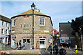
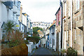
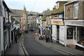
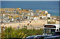
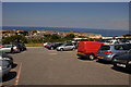
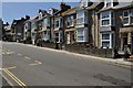
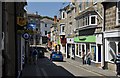
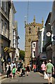
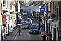
100 photos from this area
Area Information
Key information about the TR26 1JN including its size, population, and administrative classification.
- Area Type
- Postcode
- Area Size
- 4140 m²
- Population
- 1226
- Population Density
- 2683 people/km²
House Prices in TR26 1JN
17
Properties
£497,667
Average Sold Price
£90,000
Lowest Price
£1,847,000
Highest Price
Showing 17 properties
| Address | Type | Beds | Baths | Last Sale Price | Last Sale Date | |
|---|---|---|---|---|---|---|
| 5 Richmond Place, St Ives, TR26 1JN | house | - | - | £565,000 | Feb 2025 | |
| 1A Richmond Place, St Ives, TR26 1JN | Maisonette | - | - | £350,000 | Sep 2023 | |
| Trewyn House, Richmond Place, St Ives, TR26 1JN | house | - | - | £1,847,000 | Dec 2022 | |
| 13 Richmond Place, St Ives, TR26 1JN | Terraced | 4 | - | £650,000 | Dec 2018 | |
| 8 Richmond Place, St Ives, TR26 1JN | house | - | - | £390,000 | Feb 2013 | |
| 4 Richmond Place, St Ives, TR26 1JN | house | - | - | £490,000 | Oct 2011 | |
| 12 Richmond Place, St Ives, TR26 1JN | house | - | - | £418,000 | Mar 2010 | |
| Richmond House, Richmond Place, St Ives, TR26 1JN | house | - | - | £450,000 | Aug 2006 | |
| 9 Richmond Place, St Ives, TR26 1JN | house | - | - | £375,000 | Sep 2004 | |
| 7 Richmond Place, St Ives, TR26 1JN | Terraced | - | - | £180,000 | Apr 2002 |
Page 1 of 2
Energy Efficiency in TR26 1JN
Amenities
Schools
| Rank | School | Type | Entry gender | Ages |
|---|
Explore more schools in this area
Go to Schools tabDemographics
Household Size
One person
most common
Accommodation Type
Houses
most common
Tenure
55
majority
Ethnic Group
White
most common
Religion
N/A
most common
Household Composition
N/A
most common
Age
47
median
Adults (30-64 years)
most common
Household Deprivation
N/A
with no deprivation
NS-SEC
32
in Lower managerial occupations
Explore more demographic insights in this area
Go to Demographics tabPlanning
Planning Constraints
- Flood RiskPremium
- Ramsar Wetland SitesPremium
- Area of Outstanding Natural BeautyPremium
- Protected Nature ReservePremium
- Protected WoodlandPremium