Area Overview for TR26 1EA
Photos of TR26 1EA
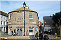
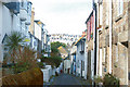
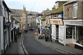
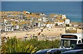
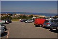
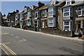
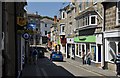
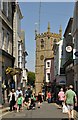
100 photos from this area
Area Information
Key information about the TR26 1EA including its size, population, and administrative classification.
- Area Type
- Postcode
- Area Size
- 2844 m²
- Population
- 1186
- Population Density
- 417057 people/km²
House Prices in TR26 1EA
17
Properties
£318,512
Average Sold Price
£80,000
Lowest Price
£745,296
Highest Price
Showing 17 properties
| Address | Type | Beds | Baths | Last Sale Price | Last Sale Date | |
|---|---|---|---|---|---|---|
| Chy-an-parc, 13 Parc Bean, St Ives, TR26 1EA | house | 6 | - | £745,296 | Oct 2023 | |
| 7 Parc Bean, St Ives, TR26 1EA | Terraced | 4 | - | £367,500 | Nov 2013 | |
| Lyndhurst, 9 Parc Bean, St Ives, TR26 1EA | house | - | - | £81,250 | Apr 1996 | |
| Woodlow, 10 Parc Bean, St Ives, TR26 1EA | Terraced | 5 | 4 | £80,000 | Jan 1995 | |
| Flat 4, Sea Breeze, 1 Parc Bean, St Ives, TR26 1EA | Flat | 1 | 1 | - | - | |
| Try Golowys, 4 Parc Bean, St Ives, TR26 1EA | Terraced | 6 | 2 | - | - | |
| Driftwood, 3 Parc Bean, St Ives, TR26 1EA | Semi-detached | 4 | 1 | - | - | |
| 12 Parc Bean, St Ives, TR26 1EA | Retail | 7 | 4 | - | - | |
| Seabreeze Cottage, Parc Bean, St Ives, TR26 1EA | Semi-detached | - | - | - | - | |
| Flat 1, Sea Breeze, 1 Parc Bean, St Ives, TR26 1EA | Flat | - | - | - | - |
Page 1 of 2
Energy Efficiency in TR26 1EA
Amenities
Schools
| Rank | School | Type | Entry gender | Ages |
|---|
Explore more schools in this area
Go to Schools tabDemographics
Household Size
Two person
most common
Accommodation Type
Houses
most common
Tenure
77
majority
Ethnic Group
White
most common
Religion
N/A
most common
Household Composition
N/A
most common
Age
47
median
Adults (30-64 years)
most common
Household Deprivation
N/A
with no deprivation
NS-SEC
28
in Lower managerial occupations
Explore more demographic insights in this area
Go to Demographics tabPlanning
Planning Constraints
- Flood RiskPremium
- Ramsar Wetland SitesPremium
- Area of Outstanding Natural BeautyPremium
- Protected Nature ReservePremium
- Protected WoodlandPremium