Area Overview for TR26 1AS
Photos of TR26 1AS
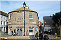
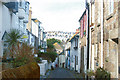
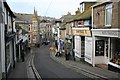
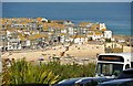
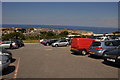
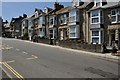
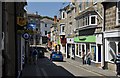
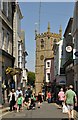
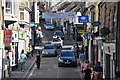
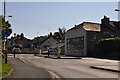
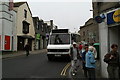
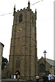
100 photos from this area
Area Information
Key information about the TR26 1AS including its size, population, and administrative classification.
- Area Type
- Postcode
- Area Size
- 1.2 hectares
- Population
- 1332
- Population Density
- 5840 people/km²
House Prices in TR26 1AS
53
Properties
£181,908
Average Sold Price
£59,450
Lowest Price
£325,000
Highest Price
Showing 53 properties
| Address | Type | Beds | Baths | Last Sale Price | Last Sale Date | |
|---|---|---|---|---|---|---|
| 22 Trelawney Avenue, St Ives, TR26 1AS | Terraced | 2 | 1 | £260,000 | Jul 2024 | |
| 50 Trelawney Avenue, St Ives, TR26 1AS | Detached | 3 | 1 | £265,000 | Oct 2023 | |
| 54 Trelawney Avenue, St Ives, TR26 1AS | Semi-detached | 2 | 1 | £325,000 | Jul 2022 | |
| 56 Trelawney Avenue, St Ives, TR26 1AS | Semi-detached | 2 | 1 | £235,000 | Dec 2019 | |
| 57 Trelawney Avenue, St Ives, TR26 1AS | Semi-detached | 2 | 1 | £190,000 | Nov 2014 | |
| 30 Trelawney Avenue, St Ives, TR26 1AS | Terraced | 2 | 1 | £143,000 | Nov 2011 | |
| 58 Trelawney Avenue, St Ives, TR26 1AS | house | 2 | - | £148,000 | Apr 2010 | |
| 48 Trelawney Avenue, St Ives, TR26 1AS | house | - | - | £162,000 | Feb 2010 | |
| Western Shore, Trelawney Avenue, St Ives, TR26 1AS | Detached | - | - | £227,500 | Sep 2006 | |
| 53 Trelawney Avenue, St Ives, TR26 1AS | Semi-detached | - | - | £105,000 | Jan 2003 |
Page 1 of 6
Energy Efficiency in TR26 1AS
Amenities
Schools
| Rank | School | Type | Entry gender | Ages |
|---|
Explore more schools in this area
Go to Schools tabDemographics
Household Size
One person
most common
Accommodation Type
Houses
most common
Tenure
44
majority
Ethnic Group
White
most common
Religion
N/A
most common
Household Composition
N/A
most common
Age
47
median
Adults (30-64 years)
most common
Household Deprivation
N/A
with no deprivation
NS-SEC
23
in Lower managerial occupations
Explore more demographic insights in this area
Go to Demographics tabPlanning
Planning Constraints
- Flood RiskPremium
- Ramsar Wetland SitesPremium
- Area of Outstanding Natural BeautyPremium
- Protected Nature ReservePremium
- Protected WoodlandPremium