Area Overview for TR18 4NE
Photos of TR18 4NE
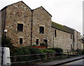
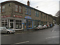
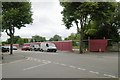
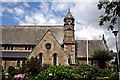
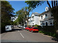
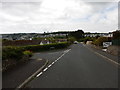
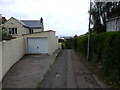
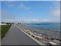
100 photos from this area
Area Information
Key information about the TR18 4NE including its size, population, and administrative classification.
- Area Type
- Postcode
- Area Size
- 8852 m²
- Population
- 1511
- Population Density
- 4732 people/km²
House Prices in TR18 4NE
25
Properties
£330,800
Average Sold Price
£190,000
Lowest Price
£515,000
Highest Price
Showing 25 properties
| Address | Type | Beds | Baths | Last Sale Price | Last Sale Date | |
|---|---|---|---|---|---|---|
| Burford, Alexandra Place, Penzance, TR18 4NE | Terraced | 4 | 3 | £515,000 | Nov 2024 | |
| Watts Farm House, Alexandra Place, Penzance, TR18 4NE | Detached | 1 | 2 | £420,000 | Oct 2018 | |
| Malvern, Alexandra Place, Penzance, TR18 4NE | house | - | - | £280,000 | Jul 2010 | |
| Trelana, Alexandra Place, Penzance, TR18 4NE | house | - | - | £249,000 | Sep 2003 | |
| Beechwood, Alexandra Place, Penzance, TR18 4NE | Terraced | 5 | 3 | £190,000 | Feb 2003 | |
| Garden House, Watts Farm House, Alexandra Place, Penzance, TR18 4NE | Detached | 2 | 2 | - | - | |
| Branksome Cottage, Alexandra Place, Penzance, TR18 4NE | Cottage | 7 | 2 | - | - | |
| Flat 5, Treyarnon, Alexandra Place, Penzance, TR18 4NE | Flat | - | - | - | - | |
| Penzance Afc, Magpie Club, Alexandra Place, Penzance, TR18 4NE | restaurant_cafe | - | - | - | - | |
| Flat 3, Treyarnon, Alexandra Place, Penzance, TR18 4NE | Flat | 1 | - | - | - |
Page 1 of 3
Energy Efficiency in TR18 4NE
Amenities
Schools
| Rank | School | Type | Entry gender | Ages |
|---|
Explore more schools in this area
Go to Schools tabDemographics
Household Size
One person
most common
Accommodation Type
Houses
most common
Tenure
51
majority
Ethnic Group
White
most common
Religion
N/A
most common
Household Composition
N/A
most common
Age
47
median
Adults (30-64 years)
most common
Household Deprivation
N/A
with no deprivation
NS-SEC
32
in Lower managerial occupations
Explore more demographic insights in this area
Go to Demographics tabPlanning
Planning Constraints
- Flood RiskPremium
- Ramsar Wetland SitesPremium
- Area of Outstanding Natural BeautyPremium
- Protected Nature ReservePremium
- Protected WoodlandPremium