Area Overview for TR18 2AY
Photos of TR18 2AY
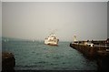


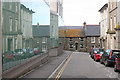


100 photos from this area
Area Information
Key information about the TR18 2AY including its size, population, and administrative classification.
- Area Type
- Postcode
- Area Size
- 3298 m²
- Population
- 1503
- Population Density
- 455680 people/km²
House Prices in TR18 2AY
9
Properties
£697,500
Average Sold Price
£345,000
Lowest Price
£1,050,000
Highest Price
Showing 9 properties
| Address | Type | Beds | Baths | Last Sale Price | Last Sale Date | |
|---|---|---|---|---|---|---|
| Chy An Brea, Access To Trevidren, Lescudjack, Penzance, TR18 2AY | house | - | - | £1,050,000 | Mar 2023 | |
| Trevidren Cottage, Access To Trevidren, Lescudjack, Penzance, TR18 2AY | Detached | 2 | 2 | £345,000 | Nov 2021 | |
| Trevidren Penthouse, Access To Trevidren, Lescudjack, Penzance, TR18 2AY | Flat | 3 | 4 | - | - | |
| Trevidren, Access To Trevidren, Lescudjack, Penzance, TR18 2AY | Detached | 3 | 4 | - | - | |
| Strand Harbour Villa, Access To Trevidren, Lescudjack, Penzance, TR18 2AY | Detached | - | - | - | - | |
| Strand Bay Villa, Access To Trevidren, Lescudjack, Penzance, TR18 2AY | Detached | - | - | - | - | |
| The Annexe, Trevidren, Access To Trevidren, Lescudjack, Penzance, TR18 2AY | house | - | - | - | - | |
| Upper Annexe, Trevidren, Access To Trevidren, Lescudjack, Penzance, TR18 2AY | Flat | - | - | - | - | |
| Garden Seaview Apartment, Trevidren, Access To Trevidren, Lescudjack, Penzance, TR18 2AY | Flat | - | - | - | - |
Energy Efficiency in TR18 2AY
Amenities
Schools
| Rank | School | Type | Entry gender | Ages |
|---|
Explore more schools in this area
Go to Schools tabDemographics
Household Size
N/A
most common
Accommodation Type
N/A
most common
Tenure
N/A
majority
Ethnic Group
N/A
most common
Religion
N/A
most common
Household Composition
N/A
most common
Age
N/A
median
N/A
most common
Household Deprivation
N/A
with no deprivation
NS-SEC
N/A
in Lower managerial occupations
Explore more demographic insights in this area
Go to Demographics tabPlanning
Planning Constraints
- Flood RiskPremium
- Ramsar Wetland SitesPremium
- Area of Outstanding Natural BeautyPremium
- Protected Nature ReservePremium
- Protected WoodlandPremium