Area Overview for TR16 5QG
Photos of TR16 5QG
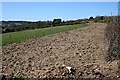
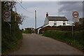
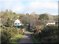
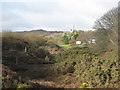


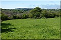
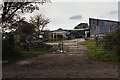
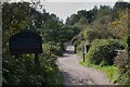

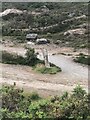
12 photos from this area
Area Information
Key information about the TR16 5QG including its size, population, and administrative classification.
- Area Type
- Postcode
- Area Size
- 25.2 hectares
- Population
- 1860
- Population Density
- 136 people/km²
House Prices in TR16 5QG
14
Properties
£248,600
Average Sold Price
£30,000
Lowest Price
£405,000
Highest Price
Showing 14 properties
| Address | Type | Beds | Baths | Last Sale Price | Last Sale Date | |
|---|---|---|---|---|---|---|
| Moles End, 10 Bownder An Sycamor, Todpool, St Day, TR16 5QG | Semi-detached | 3 | 1 | £330,000 | Feb 2024 | |
| The Cottage, Bownder An Sycamor, Todpool, St Day, TR16 5QG | house | - | - | £405,000 | Oct 2020 | |
| 9 Bownder An Sycamor, Todpool, St Day, TR16 5QG | house | 4 | 3 | £286,000 | Jun 2012 | |
| Careless Whisper, 8 Bownder An Sycamor, Todpool, St Day, TR16 5QG | house | 3 | - | £192,000 | Oct 2005 | |
| Rock Wren Cottage, 4 Bownder An Sycamor, Todpool, St Day, TR16 5QG | Detached | - | - | £30,000 | Mar 1996 | |
| Trenwheal, Bownder An Sycamor, Todpool, St Day, TR16 5QG | Detached | - | - | - | - | |
| 3A Bownder An Sycamor, Todpool, St Day, TR16 5QG | Semi-detached | - | - | - | - | |
| Greystown, Bownder An Sycamor, Todpool, St Day, TR16 5QG | Detached | - | - | - | - | |
| 7 Bownder An Sycamor, Todpool, St Day, TR16 5QG | Detached | - | - | - | - | |
| 6 Bownder An Sycamor, Todpool, St Day, TR16 5QG | house | - | - | - | - |
Page 1 of 2
Energy Efficiency in TR16 5QG
Amenities
Schools
| Rank | School | Type | Entry gender | Ages |
|---|
Explore more schools in this area
Go to Schools tabDemographics
Household Size
Two person
most common
Accommodation Type
Houses
most common
Tenure
69
majority
Ethnic Group
White
most common
Religion
N/A
most common
Household Composition
N/A
most common
Age
47
median
Adults (30-64 years)
most common
Household Deprivation
N/A
with no deprivation
NS-SEC
34
in Lower managerial occupations
Explore more demographic insights in this area
Go to Demographics tabPlanning
Planning Constraints
- Flood RiskPremium
- Ramsar Wetland SitesPremium
- Area of Outstanding Natural BeautyPremium
- Protected Nature ReservePremium
- Protected WoodlandPremium