Area Overview for TR15 2JF
Photos of TR15 2JF
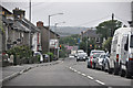
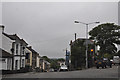
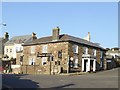
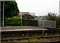
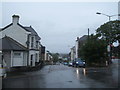
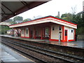
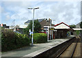
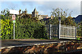
50 photos from this area
Area Information
Key information about the TR15 2JF including its size, population, and administrative classification.
- Area Type
- Postcode
- Area Size
- 2.0 hectares
- Population
- 1905
- Population Density
- 5435 people/km²
House Prices in TR15 2JF
19
Properties
£203,023
Average Sold Price
£30,000
Lowest Price
£300,000
Highest Price
Showing 19 properties
| Address | Type | Beds | Baths | Last Sale Price | Last Sale Date | |
|---|---|---|---|---|---|---|
| 25 Park Road, Redruth, TR15 2JF | house | 3 | - | £300,000 | Aug 2023 | |
| 5 Park Road, Redruth, TR15 2JF | Semi-detached | 4 | 2 | £278,000 | Sep 2020 | |
| 15 Park Road, Redruth, TR15 2JF | Semi-detached | 3 | 1 | £160,000 | Apr 2017 | |
| 21 Park Road, Redruth, TR15 2JF | house | 3 | - | £185,000 | Mar 2013 | |
| 19 Park Road, Redruth, TR15 2JF | house | 3 | - | £226,000 | Apr 2011 | |
| 7 Park Road, Redruth, TR15 2JF | Semi-detached | 4 | 1 | £250,000 | Apr 2008 | |
| 9 Park Road, Redruth, TR15 2JF | Semi-detached | 5 | 2 | £249,999 | Jun 2007 | |
| 11 Park Road, Redruth, TR15 2JF | Semi-detached | 2 | - | £275,000 | Apr 2007 | |
| 23 Park Road, Redruth, TR15 2JF | house | - | - | £190,000 | Feb 2005 | |
| 13 Park Road, Redruth, TR15 2JF | house | - | - | £89,250 | Apr 2001 |
Page 1 of 2
Energy Efficiency in TR15 2JF
Amenities
Schools
| Rank | School | Type | Entry gender | Ages |
|---|
Explore more schools in this area
Go to Schools tabDemographics
Household Size
One person
most common
Accommodation Type
Houses
most common
Tenure
54
majority
Ethnic Group
White
most common
Religion
N/A
most common
Household Composition
N/A
most common
Age
47
median
Adults (30-64 years)
most common
Household Deprivation
N/A
with no deprivation
NS-SEC
26
in Lower managerial occupations
Explore more demographic insights in this area
Go to Demographics tabPlanning
Planning Constraints
- Flood RiskPremium
- Ramsar Wetland SitesPremium
- Area of Outstanding Natural BeautyPremium
- Protected Nature ReservePremium
- Protected WoodlandPremium