Area Overview for TR14 8QA
Photos of TR14 8QA

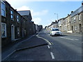
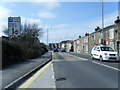
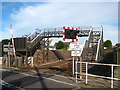
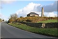
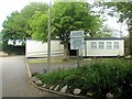
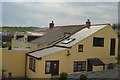
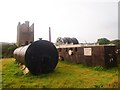
49 photos from this area
Area Information
Key information about the TR14 8QA including its size, population, and administrative classification.
- Area Type
- Postcode
- Area Size
- 3.1 hectares
- Population
- 1667
- Population Density
- 3356 people/km²
House Prices in TR14 8QA
59
Properties
£100,827
Average Sold Price
£27,625
Lowest Price
£200,000
Highest Price
Showing 59 properties
| Address | Type | Beds | Baths | Last Sale Price | Last Sale Date | |
|---|---|---|---|---|---|---|
| 53 Trenance Road, Camborne, TR14 8QA | Retail | 3 | 2 | £200,000 | Oct 2022 | |
| 15 Trenance Road, Camborne, TR14 8QA | Flat | - | - | £85,000 | Oct 2017 | |
| 33 Trenance Road, Camborne, TR14 8QA | Flat | - | - | £90,000 | May 2017 | |
| 43 Trenance Road, Camborne, TR14 8QA | Flat | - | - | £90,000 | Jul 2016 | |
| 75 Trenance Road, Camborne, TR14 8QA | house | - | - | £101,850 | Mar 2011 | |
| 4 Trenance Road, Camborne, TR14 8QA | house | 2 | - | £107,500 | Oct 2010 | |
| 69 Trenance Road, Camborne, TR14 8QA | Terraced | - | - | £124,000 | Apr 2006 | |
| 8 Trenance Road, Camborne, TR14 8QA | house | - | - | £130,500 | Oct 2005 | |
| 59 Trenance Road, Camborne, TR14 8QA | house | 3 | - | £130,000 | May 2005 | |
| 67 Trenance Road, Camborne, TR14 8QA | house | - | - | £59,950 | Nov 2001 |
Page 1 of 6
Energy Efficiency in TR14 8QA
Amenities
Schools
| Rank | School | Type | Entry gender | Ages |
|---|
Explore more schools in this area
Go to Schools tabDemographics
Household Size
Two person
most common
Accommodation Type
Houses
most common
Tenure
53
majority
Ethnic Group
White
most common
Religion
N/A
most common
Household Composition
N/A
most common
Age
47
median
Adults (30-64 years)
most common
Household Deprivation
N/A
with no deprivation
NS-SEC
21
in Lower managerial occupations
Explore more demographic insights in this area
Go to Demographics tabPlanning
Planning Constraints
- Flood RiskPremium
- Ramsar Wetland SitesPremium
- Area of Outstanding Natural BeautyPremium
- Protected Nature ReservePremium
- Protected WoodlandPremium