Area Overview for TR14 8FN
Photos of TR14 8FN

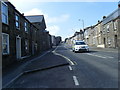
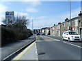
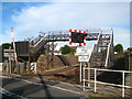
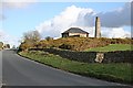
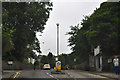
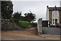

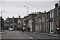
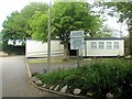

49 photos from this area
Area Information
Key information about the TR14 8FN including its size, population, and administrative classification.
- Area Type
- Postcode
- Area Size
- 8374 m²
- Population
- 1422
- Population Density
- 6689 people/km²
House Prices in TR14 8FN
49
Properties
£160,026
Average Sold Price
£170
Lowest Price
£245,000
Highest Price
Showing 49 properties
| Address | Type | Beds | Baths | Last Sale Price | Last Sale Date | |
|---|---|---|---|---|---|---|
| 31 Nicholas Holman Road, Camborne, TR14 8FN | Terraced | 2 | 1 | £175,000 | Jan 2025 | |
| 23A Nicholas Holman Road, Camborne, TR14 8FN | Semi-detached | 4 | 1 | £245,000 | Aug 2024 | |
| 37 Nicholas Holman Road, Camborne, TR14 8FN | Detached | 2 | 1 | £181,250 | Feb 2022 | |
| 43 Nicholas Holman Road, Camborne, TR14 8FN | house | - | - | £135,000 | Feb 2021 | |
| 44 Nicholas Holman Road, Camborne, TR14 8FN | Terraced | 4 | 1 | £170,000 | Feb 2021 | |
| 39 Nicholas Holman Road, Camborne, TR14 8FN | Terraced | 2 | - | £157,000 | Nov 2020 | |
| 46 Nicholas Holman Road, Camborne, TR14 8FN | Terraced | 3 | 1 | £175,000 | Sep 2019 | |
| 35 Nicholas Holman Road, Camborne, TR14 8FN | Terraced | 2 | - | £146,000 | May 2019 | |
| 47 Nicholas Holman Road, Camborne, TR14 8FN | Terraced | - | - | £167,750 | Aug 2016 | |
| 45 Nicholas Holman Road, Camborne, TR14 8FN | house | - | - | £165,000 | Jul 2016 |
Page 1 of 5
Energy Efficiency in TR14 8FN
Amenities
Schools
| Rank | School | Type | Entry gender | Ages |
|---|
Explore more schools in this area
Go to Schools tabDemographics
Household Size
Family (3-5 people)
most common
Accommodation Type
Houses
most common
Tenure
50
majority
Ethnic Group
White
most common
Religion
N/A
most common
Household Composition
N/A
most common
Age
47
median
Adults (30-64 years)
most common
Household Deprivation
N/A
with no deprivation
NS-SEC
27
in Lower managerial occupations
Explore more demographic insights in this area
Go to Demographics tabPlanning
Planning Constraints
- Flood RiskPremium
- Ramsar Wetland SitesPremium
- Area of Outstanding Natural BeautyPremium
- Protected Nature ReservePremium
- Protected WoodlandPremium