Area Overview for TR13 9PF
Photos of TR13 9PF
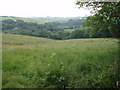
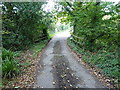
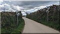
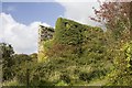
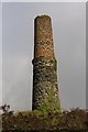
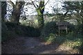
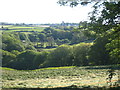
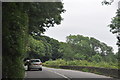
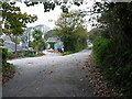
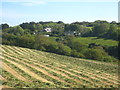
11 photos from this area
Area Information
Key information about the TR13 9PF including its size, population, and administrative classification.
- Area Type
- Postcode
- Area Size
- 6.0 hectares
- Population
- 1549
- Population Density
- 136 people/km²
House Prices in TR13 9PF
23
Properties
£205,500
Average Sold Price
£55,000
Lowest Price
£378,000
Highest Price
Showing 23 properties
| Address | Type | Beds | Baths | Last Sale Price | Last Sale Date | |
|---|---|---|---|---|---|---|
| 8 Coulthard Drive, Breage, TR13 9PF | Detached | 2 | 1 | £350,000 | Sep 2025 | |
| 29 Coulthard Drive, Breage, TR13 9PF | Retail | 3 | 1 | £290,000 | Sep 2022 | |
| 14 Coulthard Drive, Breage, TR13 9PF | Bungalow | 2 | - | £378,000 | Aug 2022 | |
| 23 Coulthard Drive, Breage, TR13 9PF | Bungalow | - | - | £250,000 | Nov 2020 | |
| Chy Byhan, 16 Coulthard Drive, Breage, TR13 9PF | Bungalow | 2 | 1 | £281,000 | Feb 2020 | |
| 12 Coulthard Drive, Breage, TR13 9PF | Semi-detached | 2 | 1 | £225,000 | Jun 2015 | |
| Applenut, 15 Coulthard Drive, Breage, TR13 9PF | Bungalow | 2 | 2 | £250,000 | Mar 2015 | |
| 22 Coulthard Drive, Breage, TR13 9PF | Bungalow | 2 | 2 | £228,500 | Dec 2014 | |
| 9 Coulthard Drive, Breage, TR13 9PF | Bungalow | 2 | - | £189,000 | Oct 2012 | |
| Keynvor, 24 Coulthard Drive, Breage, TR13 9PF | Bungalow | 3 | - | £207,500 | May 2012 |
Page 1 of 3
Energy Efficiency in TR13 9PF
Amenities
Schools
| Rank | School | Type | Entry gender | Ages |
|---|
Explore more schools in this area
Go to Schools tabDemographics
Household Size
Two person
most common
Accommodation Type
Houses
most common
Tenure
80
majority
Ethnic Group
White
most common
Religion
N/A
most common
Household Composition
N/A
most common
Age
47
median
Adults (30-64 years)
most common
Household Deprivation
N/A
with no deprivation
NS-SEC
34
in Lower managerial occupations
Explore more demographic insights in this area
Go to Demographics tabPlanning
Planning Constraints
- Flood RiskPremium
- Ramsar Wetland SitesPremium
- Area of Outstanding Natural BeautyPremium
- Protected Nature ReservePremium
- Protected WoodlandPremium