Area Overview for TR12 7HA
Photos of TR12 7HA

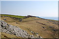

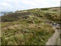
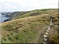
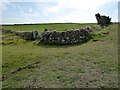

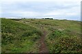
35 photos from this area
Area Information
Key information about the TR12 7HA including its size, population, and administrative classification.
- Area Type
- Postcode
- Area Size
- 1.1 km²
- Population
- 2302
- Population Density
- 114 people/km²
House Prices in TR12 7HA
19
Properties
£398,250
Average Sold Price
£160,000
Lowest Price
£715,000
Highest Price
Showing 19 properties
| Address | Type | Beds | Baths | Last Sale Price | Last Sale Date | |
|---|---|---|---|---|---|---|
| Bos Vean, Predannack, Mullion, TR12 7HA | Bungalow | 2 | - | £460,000 | Feb 2025 | |
| Penrhoss, Predannack, Mullion, TR12 7HA | Cottage | 2 | 3 | £404,500 | Sep 2019 | |
| Caunce Head, Predannack, Mullion, TR12 7HA | Mobile Home | 4 | - | £715,000 | Jan 2018 | |
| Rose Cottage, Predannack, Mullion, TR12 7HA | house | - | - | £375,000 | Jan 2018 | |
| Thistle Hollow Cottage, Predannack, Mullion, TR12 7HA | Detached | - | - | £275,000 | Jul 2001 | |
| Predannack Morvah, Predannack, Mullion, TR12 7HA | Detached | 1 | 1 | £160,000 | Sep 1996 | |
| The Milling House, Predannack Manor, Predannack, Mullion, TR12 7HA | Terraced | 2 | 2 | - | - | |
| Southernwood, Predannack, Mullion, TR12 7HA | Terraced | 1 | 2 | - | - | |
| The Granary, Predannack Manor, Predannack, Mullion, TR12 7HA | Terraced | - | - | - | - | |
| The Sheaving Barn, Predannack Manor, Predannack, Mullion, TR12 7HA | Detached | - | - | - | - |
Page 1 of 2
Energy Efficiency in TR12 7HA
Amenities
Schools
| Rank | School | Type | Entry gender | Ages |
|---|
Explore more schools in this area
Go to Schools tabDemographics
Household Size
Two person
most common
Accommodation Type
Houses
most common
Tenure
73
majority
Ethnic Group
White
most common
Religion
N/A
most common
Household Composition
N/A
most common
Age
47
median
Adults (30-64 years)
most common
Household Deprivation
N/A
with no deprivation
NS-SEC
31
in Lower managerial occupations
Explore more demographic insights in this area
Go to Demographics tabPlanning
Planning Constraints
- Flood RiskPremium
- Ramsar Wetland SitesPremium
- Area of Outstanding Natural BeautyPremium
- Protected Nature ReservePremium
- Protected WoodlandPremium