Area Overview for TR12 6SE
Photos of TR12 6SE
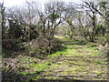
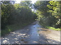
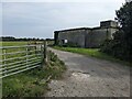
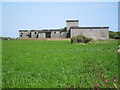
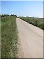
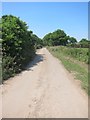
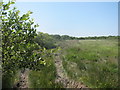
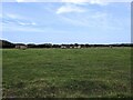
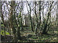
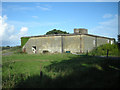
13 photos from this area
Area Information
Key information about the TR12 6SE including its size, population, and administrative classification.
- Area Type
- Postcode
- Area Size
- 84.9 hectares
- Population
- 2075
- Population Density
- 50 people/km²
House Prices in TR12 6SE
16
Properties
£229,625
Average Sold Price
£58,000
Lowest Price
£452,500
Highest Price
Showing 16 properties
| Address | Type | Beds | Baths | Last Sale Price | Last Sale Date | |
|---|---|---|---|---|---|---|
| Treprenn Vean, Pednavounder, Coverack, TR12 6SE | Semi-detached | 3 | - | £315,000 | Aug 2014 | |
| Pednavounder Farm, Pednavounder, Coverack, TR12 6SE | house | - | - | £452,500 | Jan 2009 | |
| Lavender Cottage, Pednavounder, Coverack, TR12 6SE | Bungalow | 2 | - | £93,000 | Dec 2000 | |
| Ped N Du, Pednavounder, Coverack, TR12 6SE | Detached | - | - | £58,000 | Jun 1995 | |
| The Carthouse, Little Pednavounder, Pednavounder, Coverack, TR12 6SE | Detached | 1 | 1 | - | - | |
| The Barn, Little Pednavounder, Pednavounder, Coverack, TR12 6SE | Detached | 3 | 2 | - | - | |
| The Farmhouse, Little Pednavounder, Pednavounder, Coverack, TR12 6SE | Detached | 5 | 2 | - | - | |
| Former Nuclear Bunker North Of Lavender Cottage, Pednavounder, Coverack, TR12 6SE | Detached | - | - | - | - | |
| Treprenn, Pednavounder, Coverack, TR12 6SE | house | - | - | - | - | |
| Trout Hall, Pednavounder, Coverack, TR12 6SE | Detached | - | - | - | - |
Page 1 of 2
Energy Efficiency in TR12 6SE
Amenities
Schools
| Rank | School | Type | Entry gender | Ages |
|---|
Explore more schools in this area
Go to Schools tabDemographics
Household Size
Two person
most common
Accommodation Type
Houses
most common
Tenure
69
majority
Ethnic Group
White
most common
Religion
N/A
most common
Household Composition
N/A
most common
Age
47
median
Adults (30-64 years)
most common
Household Deprivation
N/A
with no deprivation
NS-SEC
29
in Lower managerial occupations
Explore more demographic insights in this area
Go to Demographics tabPlanning
Planning Constraints
- Flood RiskPremium
- Ramsar Wetland SitesPremium
- Area of Outstanding Natural BeautyPremium
- Protected Nature ReservePremium
- Protected WoodlandPremium