Area Overview for TR11 5NG
Photos of TR11 5NG
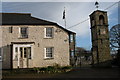
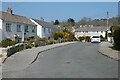
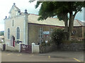
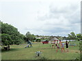
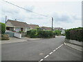
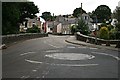
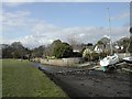
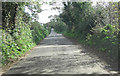
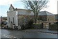
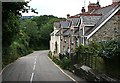
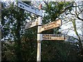
14 photos from this area
Area Information
Key information about the TR11 5NG including its size, population, and administrative classification.
- Area Type
- Postcode
- Area Size
- 9321 m²
- Population
- 1511
- Population Density
- 163 people/km²
House Prices in TR11 5NG
12
Properties
£228,125
Average Sold Price
£100,000
Lowest Price
£327,500
Highest Price
Showing 12 properties
| Address | Type | Beds | Baths | Last Sale Price | Last Sale Date | |
|---|---|---|---|---|---|---|
| 4 Waterings Road, Mylor Bridge, TR11 5NG | house | - | - | £325,000 | Mar 2019 | |
| Clinton House, Waterings Road, Mylor Bridge, TR11 5NG | house | - | - | £327,500 | Mar 2016 | |
| 2 Waterings Road, Mylor Bridge, TR11 5NG | Terraced | 3 | - | £160,000 | Jan 2015 | |
| 3 Waterings Road, Mylor Bridge, TR11 5NG | house | - | - | £100,000 | Nov 2001 | |
| 6 Waterings Road, Mylor Bridge, TR11 5NG | Land | 3 | - | - | - | |
| Togwenhu, 1A Waterings Road, Mylor Bridge, TR11 5NG | Detached | 3 | - | - | - | |
| Chy Pons, Waterings Road, Mylor Bridge, TR11 5NG | Detached | - | - | - | - | |
| 1 Rosehill, Mylor Bridge, TR11 5NG | Detached | - | - | - | - | |
| Carrick District Council, Public Conveniences, Playing Field, Waterings Road, Mylor Bridge, TR11 5NG | commercial | - | - | - | - | |
| 5 Waterings Road, Mylor Bridge, TR11 5NG | house | - | - | - | - |
Page 1 of 2
Energy Efficiency in TR11 5NG
Amenities
Schools
| Rank | School | Type | Entry gender | Ages |
|---|
Explore more schools in this area
Go to Schools tabDemographics
Household Size
Two person
most common
Accommodation Type
Houses
most common
Tenure
82
majority
Ethnic Group
White
most common
Religion
N/A
most common
Household Composition
N/A
most common
Age
47
median
Elderly (65+ years)
most common
Household Deprivation
N/A
with no deprivation
NS-SEC
46
in Lower managerial occupations
Explore more demographic insights in this area
Go to Demographics tabPlanning
Planning Constraints
- Flood RiskPremium
- Ramsar Wetland SitesPremium
- Area of Outstanding Natural BeautyPremium
- Protected Nature ReservePremium
- Protected WoodlandPremium