Area Overview for TR11 4PW
Photos of TR11 4PW

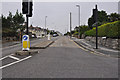

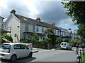
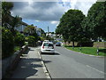
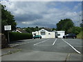
46 photos from this area
Area Information
Key information about the TR11 4PW including its size, population, and administrative classification.
- Area Type
- Postcode
- Area Size
- 1.3 hectares
- Population
- 1513
- Population Density
- 2587 people/km²
House Prices in TR11 4PW
14
Properties
£244,160
Average Sold Price
£34,000
Lowest Price
£570,000
Highest Price
Showing 14 properties
| Address | Type | Beds | Baths | Last Sale Price | Last Sale Date | |
|---|---|---|---|---|---|---|
| 72 Mongleath Road, Falmouth, TR11 4PW | Detached | 5 | 2 | £570,000 | Jun 2025 | |
| 84 Mongleath Road, Falmouth, TR11 4PW | Bungalow | 2 | 1 | £250,000 | Feb 2025 | |
| Tamarisk, 88 Mongleath Road, Falmouth, TR11 4PW | Bungalow | 2 | 1 | £365,000 | Nov 2023 | |
| 78 Mongleath Road, Falmouth, TR11 4PW | Detached | 4 | 1 | £385,000 | Mar 2017 | |
| 70 Mongleath Road, Falmouth, TR11 4PW | Detached | - | - | £420,000 | Aug 2009 | |
| 90 Mongleath Road, Falmouth, TR11 4PW | Semi-detached | - | - | £225,000 | Sep 2007 | |
| 66 Mongleath Road, Falmouth, TR11 4PW | Detached | - | - | £90,000 | Sep 1999 | |
| 86 Mongleath Road, Falmouth, TR11 4PW | Semi-detached | - | - | £53,600 | Sep 1997 | |
| 76 Mongleath Road, Falmouth, TR11 4PW | Detached | - | - | £49,000 | Feb 1996 | |
| 74 Mongleath Road, Falmouth, TR11 4PW | Detached | - | - | £34,000 | Jan 1995 |
Page 1 of 2
Energy Efficiency in TR11 4PW
Amenities
Schools
| Rank | School | Type | Entry gender | Ages |
|---|
Explore more schools in this area
Go to Schools tabDemographics
Household Size
Two person
most common
Accommodation Type
Houses
most common
Tenure
78
majority
Ethnic Group
White
most common
Religion
N/A
most common
Household Composition
N/A
most common
Age
47
median
Adults (30-64 years)
most common
Household Deprivation
N/A
with no deprivation
NS-SEC
31
in Lower managerial occupations
Explore more demographic insights in this area
Go to Demographics tabPlanning
Planning Constraints
- Flood RiskPremium
- Ramsar Wetland SitesPremium
- Area of Outstanding Natural BeautyPremium
- Protected Nature ReservePremium
- Protected WoodlandPremium