Area Overview for TR11 2SZ
Photos of TR11 2SZ
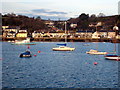
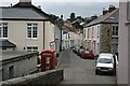
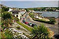
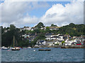

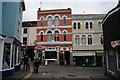
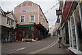
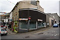
100 photos from this area
Area Information
Key information about the TR11 2SZ including its size, population, and administrative classification.
- Area Type
- Postcode
- Area Size
- 1.7 hectares
- Population
- 1712
- Population Density
- 6564 people/km²
House Prices in TR11 2SZ
16
Properties
£760,556
Average Sold Price
£185,000
Lowest Price
£1,400,000
Highest Price
Showing 16 properties
| Address | Type | Beds | Baths | Last Sale Price | Last Sale Date | |
|---|---|---|---|---|---|---|
| 4 Tehidy Terrace, Falmouth, TR11 2SZ | Semi-detached | 5 | 2 | £1,400,000 | Jan 2025 | |
| 9 Tehidy Terrace, Falmouth, TR11 2SZ | Terraced | 5 | 3 | £1,060,000 | Oct 2023 | |
| 11 Tehidy Terrace, Falmouth, TR11 2SZ | Semi-detached | 4 | 1 | £700,000 | Sep 2019 | |
| 5 Tehidy Terrace, Falmouth, TR11 2SZ | Terraced | 5 | 2 | £825,000 | Jun 2017 | |
| 10 Tehidy Terrace, Falmouth, TR11 2SZ | Semi-detached | 4 | 2 | £625,000 | Aug 2014 | |
| 3 Tehidy Terrace, Falmouth, TR11 2SZ | house | - | - | £650,000 | May 2012 | |
| Poltesco, Tehidy Terrace, Falmouth, TR11 2SZ | house | - | - | £1,200,000 | Mar 2012 | |
| Crescendo Court, Tehidy Terrace, Falmouth, TR11 2SZ | house | - | - | £200,000 | Mar 2002 | |
| 1 Tehidy Terrace, Falmouth, TR11 2SZ | Terraced | - | - | £185,000 | May 1998 | |
| Tamaris, 2 Tehidy Terrace, Falmouth, TR11 2SZ | Terraced | 5 | 3 | - | - |
Page 1 of 2
Energy Efficiency in TR11 2SZ
Amenities
Schools
| Rank | School | Type | Entry gender | Ages |
|---|
Explore more schools in this area
Go to Schools tabDemographics
Household Size
Family (3-5 people)
most common
Accommodation Type
Houses
most common
Tenure
38
majority
Ethnic Group
White
most common
Religion
N/A
most common
Household Composition
N/A
most common
Age
47
median
Adults (30-64 years)
most common
Household Deprivation
N/A
with no deprivation
NS-SEC
17
in Lower managerial occupations
Explore more demographic insights in this area
Go to Demographics tabPlanning
Planning Constraints
- Flood RiskPremium
- Ramsar Wetland SitesPremium
- Area of Outstanding Natural BeautyPremium
- Protected Nature ReservePremium
- Protected WoodlandPremium