Area Overview for TR10 9BW
Photos of TR10 9BW
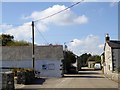
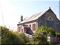
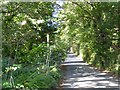
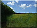
20 photos from this area
Area Information
Key information about the TR10 9BW including its size, population, and administrative classification.
- Area Type
- Postcode
- Area Size
- 12.0 hectares
- Population
- 2936
- Population Density
- 272 people/km²
House Prices in TR10 9BW
8
Properties
£289,900
Average Sold Price
£207,500
Lowest Price
£324,000
Highest Price
Showing 8 properties
| Address | Type | Beds | Baths | Last Sale Price | Last Sale Date | |
|---|---|---|---|---|---|---|
| Meadowside, Treverva, Penryn, TR10 9BW | Terraced | 2 | 1 | £283,000 | Jun 2022 | |
| River View, Treverva, Penryn, TR10 9BW | house | 2 | - | £207,500 | Apr 2017 | |
| Glyn Garth, Treverva, Penryn, TR10 9BW | Detached | 3 | - | £315,000 | Jul 2014 | |
| Halzephron, Treverva, Penryn, TR10 9BW | Bungalow | - | - | £324,000 | Jun 2014 | |
| Pumpkin Cottage, Treverva, Penryn, TR10 9BW | Cottage | 3 | - | £320,000 | Feb 2014 | |
| 2, Treverva Cottages, Treverva, Penryn, TR10 9BW | Semi-detached | 3 | 2 | - | - | |
| 1, Treverva Cottages, Treverva, Penryn, TR10 9BW | house | 3 | - | - | - | |
| West Wing, Treverva, Penryn, TR10 9BW | Semi-detached | - | - | - | - |
Energy Efficiency in TR10 9BW
Amenities
Schools
| Rank | School | Type | Entry gender | Ages |
|---|
Explore more schools in this area
Go to Schools tabDemographics
Household Size
Two person
most common
Accommodation Type
Houses
most common
Tenure
72
majority
Ethnic Group
White
most common
Religion
N/A
most common
Household Composition
N/A
most common
Age
22
median
Young Adults (15-29 years)
most common
Household Deprivation
N/A
with no deprivation
NS-SEC
18
in Lower managerial occupations
Explore more demographic insights in this area
Go to Demographics tabPlanning
Planning Constraints
- Flood RiskPremium
- Ramsar Wetland SitesPremium
- Area of Outstanding Natural BeautyPremium
- Protected Nature ReservePremium
- Protected WoodlandPremium