Area Overview for TR1 3RR
Photos of TR1 3RR
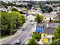
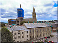
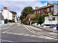
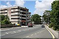
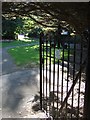
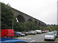
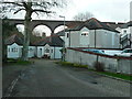
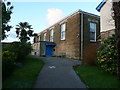
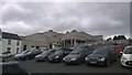
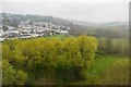
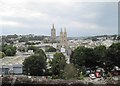

74 photos from this area
Area Information
Key information about the TR1 3RR including its size, population, and administrative classification.
- Area Type
- Postcode
- Area Size
- 7.8 hectares
- Population
- 1445
- Population Density
- 1947 people/km²
House Prices in TR1 3RR
23
Properties
£284,975
Average Sold Price
£127,000
Lowest Price
£525,000
Highest Price
Showing 23 properties
| Address | Type | Beds | Baths | Last Sale Price | Last Sale Date | |
|---|---|---|---|---|---|---|
| 3 Bishops Close, Kenwyn, TR1 3RR | Bungalow | 3 | 1 | £370,000 | Jul 2025 | |
| 6 Bishops Close, Kenwyn, TR1 3RR | Bungalow | 3 | - | £327,000 | Mar 2023 | |
| 13 Bishops Close, Kenwyn, TR1 3RR | Bungalow | 3 | 1 | £350,000 | Mar 2023 | |
| Skewjack, 9 Bishops Close, Kenwyn, TR1 3RR | Bungalow | 3 | - | £169,500 | Jan 2023 | |
| 11 Bishops Close, Kenwyn, TR1 3RR | Bungalow | 3 | 1 | £330,000 | Sep 2022 | |
| 20 Bishops Close, Kenwyn, TR1 3RR | Bungalow | 4 | 1 | £525,000 | Aug 2022 | |
| 17 Bishops Close, Kenwyn, TR1 3RR | Detached | 2 | 2 | £145,000 | Dec 2019 | |
| 4 Bishops Close, Kenwyn, TR1 3RR | Bungalow | 3 | 1 | £252,500 | Apr 2018 | |
| 24 Bishops Close, Kenwyn, TR1 3RR | Bungalow | 2 | - | £310,000 | Mar 2018 | |
| 18 Bishops Close, Kenwyn, TR1 3RR | Bungalow | 3 | 1 | £395,000 | Jun 2017 |
Page 1 of 3
Energy Efficiency in TR1 3RR
Amenities
Schools
| Rank | School | Type | Entry gender | Ages |
|---|
Explore more schools in this area
Go to Schools tabDemographics
Household Size
One person
most common
Accommodation Type
Houses
most common
Tenure
74
majority
Ethnic Group
White
most common
Religion
N/A
most common
Household Composition
N/A
most common
Age
47
median
Adults (30-64 years)
most common
Household Deprivation
N/A
with no deprivation
NS-SEC
38
in Lower managerial occupations
Explore more demographic insights in this area
Go to Demographics tabPlanning
Planning Constraints
- Flood RiskPremium
- Ramsar Wetland SitesPremium
- Area of Outstanding Natural BeautyPremium
- Protected Nature ReservePremium
- Protected WoodlandPremium