Area Overview for TQ9 6HA
Photos of TQ9 6HA
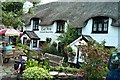
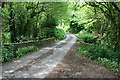
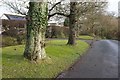
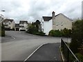
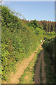
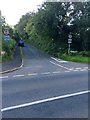
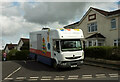
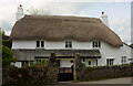
44 photos from this area
Area Information
Key information about the TQ9 6HA including its size, population, and administrative classification.
- Area Type
- Postcode
- Area Size
- 2.2 hectares
- Population
- 2147
- Population Density
- 174 people/km²
House Prices in TQ9 6HA
9
Properties
£521,667
Average Sold Price
£390,000
Lowest Price
£625,000
Highest Price
Showing 9 properties
| Address | Type | Beds | Baths | Last Sale Price | Last Sale Date | |
|---|---|---|---|---|---|---|
| Cherrybrook, Cott Road To Clay Lane, Dartington, TQ9 6HA | Detached | 3 | - | £625,000 | Mar 2023 | |
| Wayfaring, Cott Road To Clay Lane, Dartington, TQ9 6HA | house | - | - | £550,000 | Nov 2018 | |
| Homefield, Cott Road To Clay Lane, Dartington, TQ9 6HA | Detached | - | - | £390,000 | Jul 2004 | |
| Moorview, Cott Road To Clay Lane, Dartington, TQ9 6HA | Detached | 4 | 3 | - | - | |
| West Ridge, Cott Road To Clay Lane, Dartington, TQ9 6HA | Semi-detached | 3 | - | - | - | |
| Cott Farm, Cott Road To Clay Lane, Dartington, TQ9 6HA | Detached | - | - | - | - | |
| The Barn, Cott Farm, Cott Road To Clay Lane, Dartington, TQ9 6HA | Semi-detached | - | - | - | - | |
| High Orchard, Cott Road To Clay Lane, Dartington, TQ9 6HA | Bungalow | - | - | - | - | |
| Hillview, Cott Road To Clay Lane, Dartington, TQ9 6HA | Bungalow | - | - | - | - |
Energy Efficiency in TQ9 6HA
Amenities
Schools
| Rank | School | Type | Entry gender | Ages |
|---|
Explore more schools in this area
Go to Schools tabDemographics
Household Size
Two person
most common
Accommodation Type
Houses
most common
Tenure
70
majority
Ethnic Group
White
most common
Religion
N/A
most common
Household Composition
N/A
most common
Age
47
median
Adults (30-64 years)
most common
Household Deprivation
N/A
with no deprivation
NS-SEC
44
in Lower managerial occupations
Explore more demographic insights in this area
Go to Demographics tabPlanning
Planning Constraints
- Flood RiskPremium
- Ramsar Wetland SitesPremium
- Area of Outstanding Natural BeautyPremium
- Protected Nature ReservePremium
- Protected WoodlandPremium