Area Overview for TQ9 5UR
Photos of TQ9 5UR

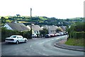
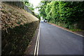
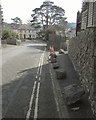
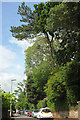

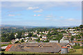
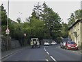

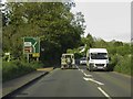
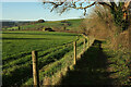
101 photos from this area
Area Information
Key information about the TQ9 5UR including its size, population, and administrative classification.
- Area Type
- Postcode
- Area Size
- 1.0 hectares
- Population
- 1888
- Population Density
- 4177 people/km²
House Prices in TQ9 5UR
17
Properties
£236,212
Average Sold Price
£77,000
Lowest Price
£456,800
Highest Price
Showing 17 properties
| Address | Type | Beds | Baths | Last Sale Price | Last Sale Date | |
|---|---|---|---|---|---|---|
| 25 Christina Park, Totnes, TQ9 5UR | house | - | - | £332,750 | Jun 2023 | |
| 36 Christina Park, Totnes, TQ9 5UR | Semi-detached | 3 | 2 | £456,800 | Jul 2022 | |
| 31 Christina Park, Totnes, TQ9 5UR | Bungalow | - | - | £273,500 | Mar 2021 | |
| 29 Christina Park, Totnes, TQ9 5UR | Semi-detached | 2 | - | £170,250 | May 2019 | |
| 33 Christina Park, Totnes, TQ9 5UR | Bungalow | 3 | 1 | £235,000 | Feb 2019 | |
| 30 Christina Park, Totnes, TQ9 5UR | house | - | - | £270,000 | Nov 2018 | |
| 32 Christina Park, Totnes, TQ9 5UR | house | 4 | 1 | £260,000 | Oct 2018 | |
| 27 Christina Park, Totnes, TQ9 5UR | Bungalow | 2 | - | £192,000 | Jul 2014 | |
| 17 Christina Park, Totnes, TQ9 5UR | house | - | - | £229,500 | Dec 2012 | |
| 37 Christina Park, Totnes, TQ9 5UR | Semi-detached | - | - | £170,000 | Aug 2008 |
Page 1 of 2
Energy Efficiency in TQ9 5UR
Amenities
Schools
| Rank | School | Type | Entry gender | Ages |
|---|
Explore more schools in this area
Go to Schools tabDemographics
Household Size
Two person
most common
Accommodation Type
Houses
most common
Tenure
67
majority
Ethnic Group
White
most common
Religion
N/A
most common
Household Composition
N/A
most common
Age
47
median
Adults (30-64 years)
most common
Household Deprivation
N/A
with no deprivation
NS-SEC
37
in Lower managerial occupations
Explore more demographic insights in this area
Go to Demographics tabPlanning
Planning Constraints
- Flood RiskPremium
- Ramsar Wetland SitesPremium
- Area of Outstanding Natural BeautyPremium
- Protected Nature ReservePremium
- Protected WoodlandPremium