Area Overview for TQ8 8LU
Photos of TQ8 8LU
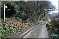
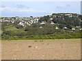
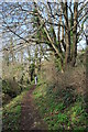
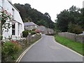
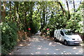
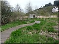
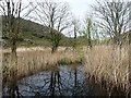
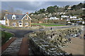
28 photos from this area
Area Information
Key information about the TQ8 8LU including its size, population, and administrative classification.
- Area Type
- Postcode
- Area Size
- 25.0 hectares
- Population
- 1175
- Population Density
- 414 people/km²
House Prices in TQ8 8LU
7
Properties
£988,738
Average Sold Price
£165,000
Lowest Price
£2,414,950
Highest Price
Showing 7 properties
| Address | Type | Beds | Baths | Last Sale Price | Last Sale Date | |
|---|---|---|---|---|---|---|
| Hanger Mill, Beadon Road, Salcombe, TQ8 8LU | house | 5 | 4 | £2,414,950 | May 2024 | |
| Sandnes, Beadon Road, Salcombe, TQ8 8LU | house | - | - | £1,000,000 | Jul 2019 | |
| Bramley Cottage, Beadon Road, Salcombe, TQ8 8LU | Detached | - | - | £375,000 | Mar 2005 | |
| Marhaba, Beadon Road, Salcombe, TQ8 8LU | Detached | - | - | £165,000 | Apr 1997 | |
| La Jolla, Beadon Road, Salcombe, TQ8 8LU | Bungalow | 4 | 2 | - | - | |
| Formerly Sandnes, Beadon Road, Salcombe, TQ8 8LU | Detached | - | - | - | - | |
| Hangar Mill Barn, Beadon Road, Salcombe, TQ8 8LU | Bungalow | - | - | - | - |
Energy Efficiency in TQ8 8LU
Amenities
Schools
| Rank | School | Type | Entry gender | Ages |
|---|
Explore more schools in this area
Go to Schools tabDemographics
Household Size
Two person
most common
Accommodation Type
Houses
most common
Tenure
71
majority
Ethnic Group
White
most common
Religion
N/A
most common
Household Composition
N/A
most common
Age
47
median
Adults (30-64 years)
most common
Household Deprivation
N/A
with no deprivation
NS-SEC
35
in Lower managerial occupations
Explore more demographic insights in this area
Go to Demographics tabPlanning
Planning Constraints
- Flood RiskPremium
- Ramsar Wetland SitesPremium
- Area of Outstanding Natural BeautyPremium
- Protected Nature ReservePremium
- Protected WoodlandPremium