Area Overview for TQ7 4RL
Photos of TQ7 4RL
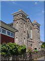
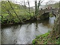
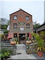
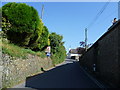


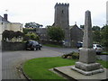

91 photos from this area
Area Information
Key information about the TQ7 4RL including its size, population, and administrative classification.
- Area Type
- Postcode
- Area Size
- 5785 m²
- Population
- 2770
- Population Density
- 50 people/km²
House Prices in TQ7 4RL
12
Properties
£326,000
Average Sold Price
£180,000
Lowest Price
£530,000
Highest Price
Showing 12 properties
| Address | Type | Beds | Baths | Last Sale Price | Last Sale Date | |
|---|---|---|---|---|---|---|
| Tyepitte House, Road From Little Reeds To Ham Butts, Loddiswell, TQ7 4RL | Detached | 4 | 5 | £380,000 | Mar 2021 | |
| LYDIARD COTTAGE, ROAD FROM LITTLE REEDS TO HAM BUTTS, Loddiswell, TQ7 4RL | Detached | 3 | 1 | £240,000 | Nov 2013 | |
| Court House, Road From Little Reeds To Ham Butts, Loddiswell, TQ7 4RL | house | 6 | 4 | £530,000 | Jan 2011 | |
| Jubilee Cottage, Road From Little Reeds To Ham Butts, Loddiswell, TQ7 4RL | Detached | 3 | - | £300,000 | Dec 2004 | |
| Granny Hines Cottage, Road From Little Reeds To Ham Butts, Loddiswell, TQ7 4RL | Terraced | - | - | £180,000 | Mar 2004 | |
| 2, Tyepitte Cottages, Road From Little Reeds To Ham Butts, Loddiswell, TQ7 4RL | Terraced | 2 | 1 | - | - | |
| 3, Tyepitte Cottages, Road From Little Reeds To Ham Butts, Loddiswell, TQ7 4RL | Terraced | 3 | 2 | - | - | |
| Middlewick Cottage, Road From Little Reeds To Ham Butts, Loddiswell, TQ7 4RL | Terraced | - | - | - | - | |
| Jacks Corner, Road From Little Reeds To Ham Butts, Loddiswell, TQ7 4RL | house | - | - | - | - | |
| 1, Tyepitte Cottages, Road From Little Reeds To Ham Butts, Loddiswell, TQ7 4RL | Cottage | 2 | 1 | - | - |
Page 1 of 2
Energy Efficiency in TQ7 4RL
Amenities
Schools
| Rank | School | Type | Entry gender | Ages |
|---|
Explore more schools in this area
Go to Schools tabDemographics
Household Size
Two person
most common
Accommodation Type
Houses
most common
Tenure
73
majority
Ethnic Group
White
most common
Religion
N/A
most common
Household Composition
N/A
most common
Age
47
median
Adults (30-64 years)
most common
Household Deprivation
N/A
with no deprivation
NS-SEC
34
in Lower managerial occupations
Explore more demographic insights in this area
Go to Demographics tabPlanning
Planning Constraints
- Flood RiskPremium
- Ramsar Wetland SitesPremium
- Area of Outstanding Natural BeautyPremium
- Protected Nature ReservePremium
- Protected WoodlandPremium