Area Overview for TQ7 4AR
Photos of TQ7 4AR
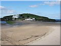
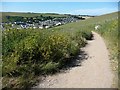
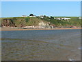
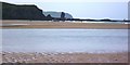
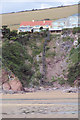
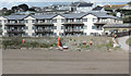
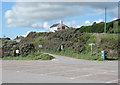
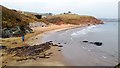
100 photos from this area
Area Information
Key information about the TQ7 4AR including its size, population, and administrative classification.
- Area Type
- Postcode
- Area Size
- 70.1 hectares
- Population
- 2080
- Population Density
- 49 people/km²
House Prices in TQ7 4AR
32
Properties
£845,500
Average Sold Price
£249,999
Lowest Price
£1,800,000
Highest Price
Showing 32 properties
| Address | Type | Beds | Baths | Last Sale Price | Last Sale Date | |
|---|---|---|---|---|---|---|
| Avonmouth, Folly Hill, Bigbury On Sea, TQ7 4AR | house | - | - | £1,800,000 | Feb 2021 | |
| Aunecliff, Folly Hill, Bigbury On Sea, TQ7 4AR | house | - | - | £1,025,000 | Oct 2015 | |
| Coromandel, Folly Hill, Bigbury On Sea, TQ7 4AR | house | 4 | - | £655,000 | Feb 2011 | |
| Burghbrook House, Folly Hill, Bigbury On Sea, TQ7 4AR | Detached | - | - | £497,500 | Nov 2005 | |
| Burgh View, Folly Hill, Bigbury On Sea, TQ7 4AR | house | - | - | £249,999 | Oct 2002 | |
| 2, Avon Quillet, Folly Hill, Bigbury On Sea, TQ7 4AR | Flat | 4 | 3 | - | - | |
| Folly House, Folly Hill, Bigbury On Sea, TQ7 4AR | house | 4 | 2 | - | - | |
| Sea Breeze, 6 Folly Hill, Bigbury On Sea, TQ7 4AR | Bungalow | 4 | 3 | - | - | |
| 4 Folly Hill, Bigbury On Sea, TQ7 4AR | Mobile Home | 2 | 1 | - | - | |
| 3 Folly Hill, Bigbury On Sea, TQ7 4AR | Bungalow | 4 | 3 | - | - |
Page 1 of 4
Energy Efficiency in TQ7 4AR
Amenities
Schools
| Rank | School | Type | Entry gender | Ages |
|---|
Explore more schools in this area
Go to Schools tabDemographics
Household Size
Two person
most common
Accommodation Type
Houses
most common
Tenure
77
majority
Ethnic Group
White
most common
Religion
N/A
most common
Household Composition
N/A
most common
Age
47
median
Adults (30-64 years)
most common
Household Deprivation
N/A
with no deprivation
NS-SEC
42
in Lower managerial occupations
Explore more demographic insights in this area
Go to Demographics tabPlanning
Planning Constraints
- Flood RiskPremium
- Ramsar Wetland SitesPremium
- Area of Outstanding Natural BeautyPremium
- Protected Nature ReservePremium
- Protected WoodlandPremium