Area Overview for TQ6 9QX
Photos of TQ6 9QX
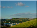
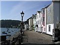
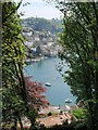
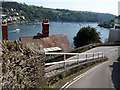
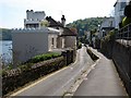
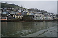
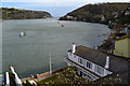
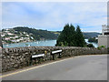
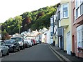
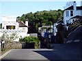

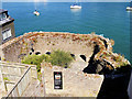
100 photos from this area
Area Information
Key information about the TQ6 9QX including its size, population, and administrative classification.
- Area Type
- Postcode
- Area Size
- 9.1 hectares
- Population
- 1485
- Population Density
- 363 people/km²
House Prices in TQ6 9QX
37
Properties
£418,877
Average Sold Price
£117,500
Lowest Price
£950,000
Highest Price
Showing 37 properties
| Address | Type | Beds | Baths | Last Sale Price | Last Sale Date | |
|---|---|---|---|---|---|---|
| 27 Crowthers Hill, Dartmouth, TQ6 9QX | Terraced | 4 | 2 | £688,930 | Nov 2025 | |
| 36 Crowthers Hill, Dartmouth, TQ6 9QX | Terraced | 2 | 1 | £480,000 | Jul 2024 | |
| 31 Crowthers Hill, Dartmouth, TQ6 9QX | Terraced | 2 | 1 | £330,000 | Jun 2024 | |
| 52 Crowthers Hill, Dartmouth, TQ6 9QX | Maisonette | 2 | 2 | £435,000 | Jun 2024 | |
| 18 Crowthers Hill, Dartmouth, TQ6 9QX | Terraced | 2 | 1 | £415,000 | Jul 2023 | |
| 19 Crowthers Hill, Dartmouth, TQ6 9QX | house | - | - | £415,000 | Jun 2023 | |
| Box Cottage, 14 Crowthers Hill, Dartmouth, TQ6 9QX | house | 3 | 1 | £475,000 | Jul 2022 | |
| Hope Cottage, 38 Crowthers Hill, Dartmouth, TQ6 9QX | house | - | - | £550,000 | Apr 2022 | |
| 5 Crowthers Hill, Dartmouth, TQ6 9QX | house | - | - | £340,000 | Jun 2021 | |
| 16 CROWTHERS HILL, Dartmouth, TQ6 9QX | Terraced | 3 | 2 | £355,000 | Jun 2021 |
Page 1 of 4
Energy Efficiency in TQ6 9QX
Amenities
Schools
| Rank | School | Type | Entry gender | Ages |
|---|
Explore more schools in this area
Go to Schools tabDemographics
Household Size
Two person
most common
Accommodation Type
Houses
most common
Tenure
80
majority
Ethnic Group
White
most common
Religion
N/A
most common
Household Composition
N/A
most common
Age
47
median
Elderly (65+ years)
most common
Household Deprivation
N/A
with no deprivation
NS-SEC
44
in Lower managerial occupations
Explore more demographic insights in this area
Go to Demographics tabPlanning
Planning Constraints
- Flood RiskPremium
- Ramsar Wetland SitesPremium
- Area of Outstanding Natural BeautyPremium
- Protected Nature ReservePremium
- Protected WoodlandPremium