Area Overview for TQ6 0RU
Photos of TQ6 0RU
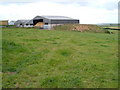
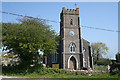
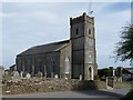
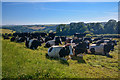
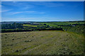
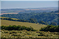
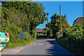
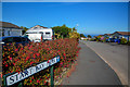
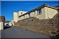
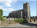
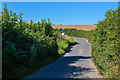
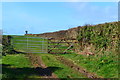
24 photos from this area
Area Information
Key information about the TQ6 0RU including its size, population, and administrative classification.
- Area Type
- Postcode
- Area Size
- 57.4 hectares
- Population
- 2086
- Population Density
- 64 people/km²
House Prices in TQ6 0RU
41
Properties
£354,233
Average Sold Price
£64,000
Lowest Price
£785,000
Highest Price
Showing 41 properties
| Address | Type | Beds | Baths | Last Sale Price | Last Sale Date | |
|---|---|---|---|---|---|---|
| 4, Start Bay Heights, Totnes Road, Strete, TQ6 0RU | house | 2 | 1 | £312,000 | Aug 2023 | |
| Hartley Cottage, Totnes Road, Strete, TQ6 0RU | house | 2 | 1 | £350,000 | Nov 2021 | |
| Walpole House, Totnes Road, Strete, TQ6 0RU | house | 3 | - | £436,000 | Sep 2021 | |
| Moortosea, Totnes Road, Strete, TQ6 0RU | Detached | 3 | 2 | £360,000 | Aug 2018 | |
| Rushford Cottage, Totnes Road, Strete, TQ6 0RU | Cottage | 3 | 1 | £217,000 | Jul 2017 | |
| Swallows Chase, Totnes Road, Strete, TQ6 0RU | Bungalow | 4 | 3 | £534,000 | Dec 2015 | |
| Inatween, Totnes Road, Strete, TQ6 0RU | Terraced | 2 | 1 | £284,000 | Jul 2014 | |
| Hillaway, Totnes Road, Strete, TQ6 0RU | Bungalow | 4 | 1 | £370,000 | Jan 2013 | |
| Cherry Orchard, Totnes Road, Strete, TQ6 0RU | Bungalow | 4 | - | £690,000 | Oct 2012 | |
| Hathersage, Totnes Road, Strete, TQ6 0RU | Terraced | - | - | £295,000 | Sep 2007 |
Page 1 of 5
Energy Efficiency in TQ6 0RU
Amenities
Schools
| Rank | School | Type | Entry gender | Ages |
|---|
Explore more schools in this area
Go to Schools tabDemographics
Household Size
Two person
most common
Accommodation Type
Houses
most common
Tenure
76
majority
Ethnic Group
White
most common
Religion
N/A
most common
Household Composition
N/A
most common
Age
47
median
Adults (30-64 years)
most common
Household Deprivation
N/A
with no deprivation
NS-SEC
39
in Lower managerial occupations
Explore more demographic insights in this area
Go to Demographics tabPlanning
Planning Constraints
- Flood RiskPremium
- Ramsar Wetland SitesPremium
- Area of Outstanding Natural BeautyPremium
- Protected Nature ReservePremium
- Protected WoodlandPremium