Area Overview for TQ5 9SN
Photos of TQ5 9SN
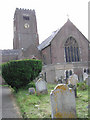
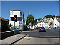
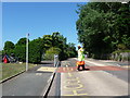
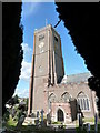
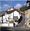
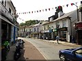
87 photos from this area
Area Information
Key information about the TQ5 9SN including its size, population, and administrative classification.
- Area Type
- Postcode
- Area Size
- 1.6 hectares
- Population
- 1372
- Population Density
- 1358 people/km²
House Prices in TQ5 9SN
26
Properties
£167,379
Average Sold Price
£54,000
Lowest Price
£310,000
Highest Price
Showing 26 properties
| Address | Type | Beds | Baths | Last Sale Price | Last Sale Date | |
|---|---|---|---|---|---|---|
| 10 Lytes Road, Brixham, TQ5 9SN | Semi-detached | 3 | - | £310,000 | May 2024 | |
| 14 Lytes Road, Brixham, TQ5 9SN | Semi-detached | 3 | 1 | £268,000 | Mar 2022 | |
| 24 Lytes Road, Brixham, TQ5 9SN | Terraced | 3 | 1 | £169,500 | Aug 2018 | |
| 12 Lytes Road, Brixham, TQ5 9SN | Semi-detached | 2 | 2 | £236,500 | Jun 2018 | |
| 22 Lytes Road, Brixham, TQ5 9SN | house | - | - | £117,000 | Jan 2018 | |
| 18 Lytes Road, Brixham, TQ5 9SN | Semi-detached | 3 | 1 | £147,000 | Nov 2015 | |
| 11 Lytes Road, Brixham, TQ5 9SN | Semi-detached | 3 | 1 | £185,000 | Jul 2015 | |
| 7 Lytes Road, Brixham, TQ5 9SN | Semi-detached | 3 | - | £159,950 | Jan 2014 | |
| 21 Lytes Road, Brixham, TQ5 9SN | Semi-detached | 3 | 1 | £160,000 | Mar 2013 | |
| 16 Lytes Road, Brixham, TQ5 9SN | house | - | - | £130,000 | Feb 2009 |
Page 1 of 3
Energy Efficiency in TQ5 9SN
Amenities
Schools
| Rank | School | Type | Entry gender | Ages |
|---|
Explore more schools in this area
Go to Schools tabDemographics
Household Size
Two person
most common
Accommodation Type
Houses
most common
Tenure
73
majority
Ethnic Group
White
most common
Religion
N/A
most common
Household Composition
N/A
most common
Age
47
median
Adults (30-64 years)
most common
Household Deprivation
N/A
with no deprivation
NS-SEC
28
in Lower managerial occupations
Explore more demographic insights in this area
Go to Demographics tabPlanning
Planning Constraints
- Flood RiskPremium
- Ramsar Wetland SitesPremium
- Area of Outstanding Natural BeautyPremium
- Protected Nature ReservePremium
- Protected WoodlandPremium