Area Overview for TQ5 9NS
Photos of TQ5 9NS
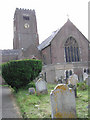
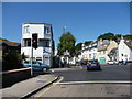
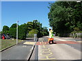
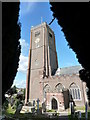
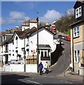
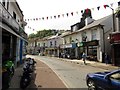
87 photos from this area
Area Information
Key information about the TQ5 9NS including its size, population, and administrative classification.
- Area Type
- Postcode
- Area Size
- 9655 m²
- Population
- 1445
- Population Density
- 6316 people/km²
House Prices in TQ5 9NS
40
Properties
£127,828
Average Sold Price
£66,500
Lowest Price
£164,500
Highest Price
Showing 40 properties
| Address | Type | Beds | Baths | Last Sale Price | Last Sale Date | |
|---|---|---|---|---|---|---|
| 2 Briseham Road, Brixham, TQ5 9NS | Flat | - | - | £130,000 | Mar 2023 | |
| 12 Briseham Road, Brixham, TQ5 9NS | Flat | 2 | 1 | £123,000 | Apr 2019 | |
| 42 Briseham Road, Brixham, TQ5 9NS | Terraced | 2 | 1 | £164,500 | Mar 2019 | |
| 34 Briseham Road, Brixham, TQ5 9NS | Terraced | 2 | 1 | £152,500 | May 2018 | |
| Flat, 50 Briseham Road, Brixham, TQ5 9NS | Semi-detached | 2 | 1 | £155,000 | Aug 2017 | |
| 50 Briseham Road, Brixham, TQ5 9NS | house | - | - | £155,000 | Aug 2017 | |
| 12A Briseham Road, Brixham, TQ5 9NS | Flat | 2 | 1 | £112,950 | Oct 2015 | |
| 26 Briseham Road, Brixham, TQ5 9NS | Maisonette | - | - | £91,000 | Jul 2009 | |
| 6A Briseham Road, Brixham, TQ5 9NS | Flat | - | - | £66,500 | Dec 2002 | |
| 26A Briseham Road, Brixham, TQ5 9NS | Flat | 2 | 1 | - | - |
Page 1 of 4
Energy Efficiency in TQ5 9NS
Amenities
Schools
| Rank | School | Type | Entry gender | Ages |
|---|
Explore more schools in this area
Go to Schools tabDemographics
Household Size
One person
most common
Accommodation Type
Houses
most common
Tenure
59
majority
Ethnic Group
White
most common
Religion
N/A
most common
Household Composition
N/A
most common
Age
47
median
Adults (30-64 years)
most common
Household Deprivation
N/A
with no deprivation
NS-SEC
21
in Lower managerial occupations
Explore more demographic insights in this area
Go to Demographics tabPlanning
Planning Constraints
- Flood RiskPremium
- Ramsar Wetland SitesPremium
- Area of Outstanding Natural BeautyPremium
- Protected Nature ReservePremium
- Protected WoodlandPremium