Area Overview for TQ5 8JN
Photos of TQ5 8JN
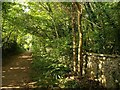
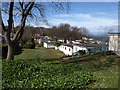
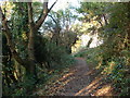
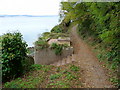
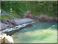
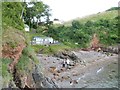
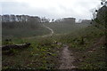
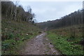
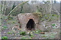
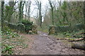
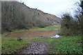
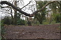
78 photos from this area
Area Information
Key information about the TQ5 8JN including its size, population, and administrative classification.
- Area Type
- Postcode
- Area Size
- 1.9 hectares
- Population
- 1255
- Population Density
- 3462 people/km²
House Prices in TQ5 8JN
34
Properties
£243,300
Average Sold Price
£73,000
Lowest Price
£411,000
Highest Price
Showing 34 properties
| Address | Type | Beds | Baths | Last Sale Price | Last Sale Date | |
|---|---|---|---|---|---|---|
| 12 Smardon Avenue, Brixham, TQ5 8JN | Semi-detached | 3 | 2 | £411,000 | Apr 2024 | |
| 29 Smardon Avenue, Brixham, TQ5 8JN | Bungalow | 3 | 1 | £350,000 | Jan 2023 | |
| 15 Smardon Avenue, Brixham, TQ5 8JN | Detached | 3 | 1 | £315,000 | Sep 2021 | |
| 2 Smardon Avenue, Brixham, TQ5 8JN | Retail | 3 | - | £364,950 | Jun 2021 | |
| 5 Smardon Avenue, Brixham, TQ5 8JN | Bungalow | 3 | - | £349,950 | Jan 2021 | |
| 25 Smardon Avenue, Brixham, TQ5 8JN | Bungalow | 2 | 1 | £308,000 | Jul 2020 | |
| 6 Smardon Avenue, Brixham, TQ5 8JN | Bungalow | 2 | 2 | £312,500 | Jan 2020 | |
| 24 Smardon Avenue, Brixham, TQ5 8JN | Semi-detached | 2 | 1 | £245,000 | May 2019 | |
| 13 Smardon Avenue, Brixham, TQ5 8JN | Bungalow | 3 | 1 | £265,000 | Jul 2018 | |
| 22 Smardon Avenue, Brixham, TQ5 8JN | Semi-detached | 2 | 1 | £222,000 | Feb 2018 |
Page 1 of 4
Energy Efficiency in TQ5 8JN
Amenities
Schools
| Rank | School | Type | Entry gender | Ages |
|---|
Explore more schools in this area
Go to Schools tabDemographics
Household Size
Two person
most common
Accommodation Type
Houses
most common
Tenure
91
majority
Ethnic Group
White
most common
Religion
N/A
most common
Household Composition
N/A
most common
Age
70
median
Elderly (65+ years)
most common
Household Deprivation
N/A
with no deprivation
NS-SEC
32
in Lower managerial occupations
Explore more demographic insights in this area
Go to Demographics tabPlanning
Planning Constraints
- Flood RiskPremium
- Ramsar Wetland SitesPremium
- Area of Outstanding Natural BeautyPremium
- Protected Nature ReservePremium
- Protected WoodlandPremium