Area Overview for TQ5 8BU
Photos of TQ5 8BU
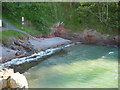
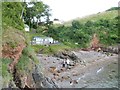
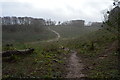
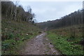
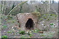
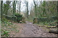
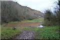
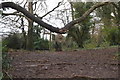
78 photos from this area
Area Information
Key information about the TQ5 8BU including its size, population, and administrative classification.
- Area Type
- Postcode
- Area Size
- 1.6 hectares
- Population
- 1504
- Population Density
- 3791 people/km²
House Prices in TQ5 8BU
64
Properties
£228,119
Average Sold Price
£124,950
Lowest Price
£380,000
Highest Price
Showing 64 properties
| Address | Type | Beds | Baths | Last Sale Price | Last Sale Date | |
|---|---|---|---|---|---|---|
| 28 Pavilions Close, Brixham, TQ5 8BU | Semi-detached | 3 | 2 | £285,000 | Mar 2025 | |
| 11 Pavilions Close, Brixham, TQ5 8BU | Terraced | 3 | 2 | £290,000 | Feb 2025 | |
| 23 Pavilions Close, Brixham, TQ5 8BU | Detached | 3 | 2 | £280,000 | Sep 2024 | |
| 60 Pavilions Close, Brixham, TQ5 8BU | Detached | 4 | 2 | £380,000 | Feb 2024 | |
| 1 Pavilions Close, Brixham, TQ5 8BU | house | 3 | - | £310,000 | Dec 2021 | |
| 25 Pavilions Close, Brixham, TQ5 8BU | Detached | 3 | 2 | £269,950 | Mar 2021 | |
| 30 Pavilions Close, Brixham, TQ5 8BU | Semi-detached | 3 | 1 | £235,000 | Dec 2020 | |
| 64 Pavilions Close, Brixham, TQ5 8BU | Semi-detached | 4 | 2 | £338,000 | Dec 2020 | |
| 53 Pavilions Close, Brixham, TQ5 8BU | Semi-detached | 3 | 1 | £220,000 | Sep 2020 | |
| 38 Pavilions Close, Brixham, TQ5 8BU | Semi-detached | 3 | 2 | £250,000 | Sep 2020 |
Page 1 of 7
Energy Efficiency in TQ5 8BU
Amenities
Schools
| Rank | School | Type | Entry gender | Ages |
|---|
Explore more schools in this area
Go to Schools tabDemographics
Household Size
Two person
most common
Accommodation Type
Houses
most common
Tenure
74
majority
Ethnic Group
White
most common
Religion
N/A
most common
Household Composition
N/A
most common
Age
47
median
Adults (30-64 years)
most common
Household Deprivation
N/A
with no deprivation
NS-SEC
27
in Lower managerial occupations
Explore more demographic insights in this area
Go to Demographics tabPlanning
Planning Constraints
- Flood RiskPremium
- Ramsar Wetland SitesPremium
- Area of Outstanding Natural BeautyPremium
- Protected Nature ReservePremium
- Protected WoodlandPremium