Area Overview for TQ5 8AY
Photos of TQ5 8AY
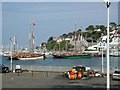
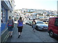
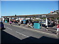
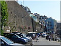
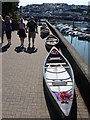
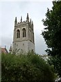
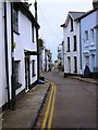
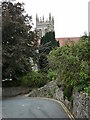
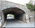

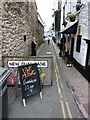
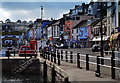
100 photos from this area
Area Information
Key information about the TQ5 8AY including its size, population, and administrative classification.
- Area Type
- Postcode
- Area Size
- 6.8 hectares
- Population
- 1487
- Population Density
- 891 people/km²
House Prices in TQ5 8AY
18
Properties
£274,921
Average Sold Price
£115,000
Lowest Price
£397,000
Highest Price
Showing 18 properties
| Address | Type | Beds | Baths | Last Sale Price | Last Sale Date | |
|---|---|---|---|---|---|---|
| 12, Dalverton Court, Blackball Lane, Brixham, TQ5 8AY | Flat | 2 | 1 | £385,000 | Oct 2024 | |
| 10, Dalverton Court, Blackball Lane, Brixham, TQ5 8AY | Flat | - | - | £310,000 | Nov 2023 | |
| 13, Dalverton Court, Blackball Lane, Brixham, TQ5 8AY | Retail | 2 | 1 | £335,000 | Jun 2022 | |
| 3, Dalverton Court, Blackball Lane, Brixham, TQ5 8AY | Flat | 2 | 1 | £397,000 | Jun 2021 | |
| 11, Dalverton Court, Blackball Lane, Brixham, TQ5 8AY | Flat | - | - | £302,500 | Mar 2021 | |
| 15, Dalverton Court, Blackball Lane, Brixham, TQ5 8AY | Flat | - | - | £283,000 | Nov 2020 | |
| 6, Dalverton Court, Blackball Lane, Brixham, TQ5 8AY | Flat | 3 | - | £342,000 | Nov 2019 | |
| 1, Dalverton Court, Blackball Lane, Brixham, TQ5 8AY | Flat | - | - | £366,388 | Feb 2019 | |
| 8, Dalverton Court, Blackball Lane, Brixham, TQ5 8AY | Flat | 2 | 1 | £280,000 | Oct 2017 | |
| 9, Dalverton Court, Blackball Lane, Brixham, TQ5 8AY | Flat | - | - | £245,000 | Aug 2014 |
Page 1 of 2
Energy Efficiency in TQ5 8AY
Amenities
Schools
| Rank | School | Type | Entry gender | Ages |
|---|
Explore more schools in this area
Go to Schools tabDemographics
Household Size
Two person
most common
Accommodation Type
Houses
most common
Tenure
86
majority
Ethnic Group
White
most common
Religion
N/A
most common
Household Composition
N/A
most common
Age
47
median
Elderly (65+ years)
most common
Household Deprivation
N/A
with no deprivation
NS-SEC
43
in Lower managerial occupations
Explore more demographic insights in this area
Go to Demographics tabPlanning
Planning Constraints
- Flood RiskPremium
- Ramsar Wetland SitesPremium
- Area of Outstanding Natural BeautyPremium
- Protected Nature ReservePremium
- Protected WoodlandPremium