Area Overview for TQ5 0SB
Photos of TQ5 0SB
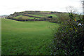
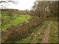
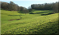
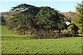
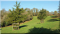
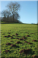
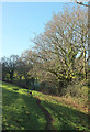
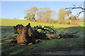
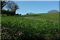
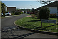
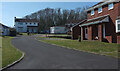
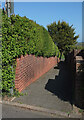
47 photos from this area
Area Information
Key information about the TQ5 0SB including its size, population, and administrative classification.
- Area Type
- Postcode
- Area Size
- 4.8 hectares
- Population
- 1243
- Population Density
- 260 people/km²
House Prices in TQ5 0SB
20
Properties
£138,995
Average Sold Price
£45,000
Lowest Price
£264,000
Highest Price
Showing 20 properties
| Address | Type | Beds | Baths | Last Sale Price | Last Sale Date | |
|---|---|---|---|---|---|---|
| 11 Rowan Way, Brixham, TQ5 0SB | Terraced | 3 | 1 | £225,000 | Nov 2023 | |
| 3 Rowan Way, Brixham, TQ5 0SB | Terraced | 3 | 1 | £264,000 | Sep 2023 | |
| 8 Rowan Way, Brixham, TQ5 0SB | house | 3 | - | £130,000 | Mar 2023 | |
| 5 Rowan Way, Brixham, TQ5 0SB | Semi-detached | 3 | 1 | £169,950 | Jul 2017 | |
| 6 Rowan Way, Brixham, TQ5 0SB | house | 3 | - | £122,000 | Nov 2012 | |
| 9 Rowan Way, Brixham, TQ5 0SB | Terraced | 3 | - | £121,000 | Oct 2012 | |
| 14 Rowan Way, Brixham, TQ5 0SB | Terraced | 3 | 1 | £125,000 | Mar 2011 | |
| 18 Rowan Way, Brixham, TQ5 0SB | Terraced | - | - | £143,000 | Jul 2007 | |
| 2 Rowan Way, Brixham, TQ5 0SB | Terraced | - | - | £45,000 | Jun 1999 | |
| 19 Rowan Way, Brixham, TQ5 0SB | house | - | - | £45,000 | Jan 1995 |
Page 1 of 2
Energy Efficiency in TQ5 0SB
Amenities
Schools
| Rank | School | Type | Entry gender | Ages |
|---|
Explore more schools in this area
Go to Schools tabDemographics
Household Size
Two person
most common
Accommodation Type
Houses
most common
Tenure
78
majority
Ethnic Group
White
most common
Religion
N/A
most common
Household Composition
N/A
most common
Age
47
median
Elderly (65+ years)
most common
Household Deprivation
N/A
with no deprivation
NS-SEC
36
in Lower managerial occupations
Explore more demographic insights in this area
Go to Demographics tabPlanning
Planning Constraints
- Flood RiskPremium
- Ramsar Wetland SitesPremium
- Area of Outstanding Natural BeautyPremium
- Protected Nature ReservePremium
- Protected WoodlandPremium